Be sure to start at the home page regarding this trip, as it has
a list of everywhere we stayed (camping and the two hotels), the
best places we ate, and some great things we recommend you visit
too on such a trip.
Saturday, Day 1.
I am nervous before every motorcycle trip. To the point of almost
being in tears. I think about everything that could go wrong. I
think about my dog being without us. I'm afraid I'll let Stefan
down.
And this time, I had extra nerves: I was going to try to do the
Lost Coast BDR X, in
Northern California. I had watched half a dozen YouTube videos. I
had read about it. I had studied the online map and the printed
map. I had practiced on gravel roads all around us. Surely I could
do this? Even just 200 miles of it?
I've already said on the home page of this trip report, and I'm
going to say it now: I didn't do it. I quit early on. I'll talk
about that later, in more detail, but I want to add that I am at
peace with my decision. Not only am I not capable of doing a
Backcountry Discovery Route,
I've realized I don't want to do a BDR. Those routes are for
highly advanced off-road riders looking for intensely technical,
challenging circumstances: tight gravel and dirt turns on steep
inclines or declines and at least some sand (if not a lot), maybe
some ridiculous rocky or muddy terrain thrown in as well, and
sharp, breath-taking drop offs on at least one side of the road,
if not both. Often there's no place to stop at all - you stop, you
fall over, because of the terrain. There's usually little room for
errors - many riders don't just fall over, they crash, and the
ride is over, either because of damage to their bikes or
themselves. A BDR ride is challenge after challenge. And if that's
why you ride a motorcycle, enjoy. Go for it. I do get the appeal
for YOU.
It's just not for me.
I enjoy gravel roads, I enjoy standing on the bike, I enjoy the
concentration that comes with maneuvering somewhat difficult
terrain. But I don't want to feel like I'm going to crash All.
The. Time. I like to take breaks. I like room for errors. I also
like views. And I also like a payoff somewhere because of the
ride: a beautiful vista. A fantastic campground. A historic ghost
ranch.
It was interesting after the trip to say on two online communities
that I quit the BDR. The women on
TwoXRiders on Reddit
were SUPER supportive, saying things like, "Sure sounds like you
still had quite an adventure!", etc. But on another group, for ADV
women riders specifically, all of the comments were about how I
needed to get busy practicing and improving so I could do a BDR -
for them, if you don't do THE hardest route to get somewhere,
you're not an adventure rider. Not sure how much longer I'll last
on that online group.
Anyone want the BDR stickers I got when we got the paper map?
'Cause they ain't going on MY panniers...
Anyway, with all that said:
We had a wonderful time. We always have at least a nice time, if
not a fantastic time, on a two-week motorcycle trip, but this was
another really WONDERFUL time.
However, as I've said before, preparing for a trip is zero fun.
The house has to be clean. Not mother-in-law-visiting but, still,
everything vacuumed and mopped, everything dusted and wiped, all
laundry done, everything put away. It's both for the dog / house
sitter and so that I come back to a clean house. I was determined
to be done a day early, not just with cleaning, but with
packing. I was
determined not to be up until midnight the night before the trip
getting ready.
I was done at 6 p.m. the night before the trip. I consider it a
victory.
Stefan chose a route for the next two days that would take us to
the Oregon Coast, a bit down it, then back inland. I have already
ridden about 80% of the Oregon Coast, and am not a fan of what
I've seen (you see very little of the coast, it's crowded, it's
really hard to find a place to camp, or even to park, etc.) - it's
why
I
don't recommend it for people coming out West to tour. But
with the route he chose, I have now done it ALL. And I can say,
with confidence:
skip
it. Do Highway 1 in Northern California and then go inland.
But I digress...
I was up at 4 a.m. with gastro issues. Which means I was so, so
tired when we officially got up. I loaded up on meds and we took
Lucy on a nice, long walk. She knew we were leaving - she knows
because of all of the packing. But I know she LOVES our dog
sitter. Still, I hate leaving her.
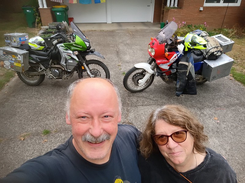
On the morning of a trip, Stefan pulls the motorcycles into the
driveway and we finish packing them up there. After we were done
and almost ready to leave, I asked a gentleman walking by to take
our photo together. Unfortunately, he didn't know how to look
through the view finder.
His
finger is in every photo he took. We had a good laugh about
it.
We took State Highway 6 to Tillamook,
went
down the coast on 101 (couldn't take 229 - it was closed
midway) and then came back inland at Newport on US Highway 20,
heading East, passing the sign that says "Boston, MA, 3,365
miles." There was no way to stop and take a photo in front of it -
it's just a sign on the side of the start of the road and SO easy
to miss.
About half way between Newport and Corvalis is the road to Harlan:
Burnt Woods Harlan Road. That's how Stefan found the campground
there: he was zooming in and out on Google, trying to figure out a
route and a campsite, and saw "Harlan." He loves the song "You'll
Never Leave Harlan Alive", as do I (he's even been to Harlan,
Kentucky!). It's a very twisty forested road, and then you end up
at the end, with the options to go left or right.
Right
is Harlan road, and it becomes gravel.
It's
a relatively easy road, but mindful that this and Burnt
Woods Road are country roads, and the locals FLY down them in
large pickups and SUVs, and not always fully on the right side of
the road.
Not a mile down this gravel road is
Big
Elk Campground. It's on the
Corvallis
To The Sea Trail (C2C), which I had never heard of until
this trip. It's glorious! There are a dozen regular campsites in
the campground of various sizes, including one that could easily
accommodate a group, and a section in the middle just for hikers
and bikers. It also has two of the cleanest, best-maintained
vaulted toilets I've ever seen. It's shaded, it has potable water
(though there's a sign on the info board that says the water
stinks in summer - and it did have a bit of a smell when we were
there) and it's just a few yards from
Big
Elk Creek. This campsite is very popular with fisherfolk,
hikers and bikers. We pretty much had it to ourselves - there was
a group at the other end in what I called the group area, but
while they had quite a large tent camping setup, they were no
where to be found - we heard them come in quite late, and they
were gone when we got up in the morning. What little road traffic
there was completely died down by the time we went to bed.
It
was one of the best first nights of a trip we've ever had.
It was definitely the best night of sleep I had ever gotten on the
first night of a trip in the tent.
I
loved our site so much.
I was in bed by 8. I was just so, so tired.
Note: Big Elk Campground is first come, first served. That means
you cannot reserve a site in advance. And payment has to be by
check or cash, as with MOST campgrounds (don't believe it when
people say ALL state and national parks are cashless - it's not
true. Yes, some are, and take credit cards, but on this trip, just
like with all others, most don't).
Also, because the ocean is just on the other side of the hills,
you can expect a thick fog / cloud cover in the morning, and
anything outside of your tent will be wet!
Sunday, Day 2.
Got up the next day after a terrific, long night of good sleep. We
walked out to the road to check out the table of stuff left over
from an estate sale next door - the free stuff. Always great
conversation pieces.
Today, I would be tackling a gravel road to Mary's Peak, via
Mary's Peak Road (National Forest Road 3011). 16 miles to paved
34. It had rained two days before, so I was quite nervous about
conditions. But if I couldn't do this, then I had no business on
the Lost Coast BDR-X, right? Well, I did it! It wasn't extremely
hard, but it wasn't easy either. Riding gravel means paying
attention and staying focused. Just as we were starting the road,
we met two hikers coming the other way - Stefan had seen a map
that showed that the road was gated, but they said they'd seen
some dirt bike riders confidently headed in the same direction, so
we decided we, too, would be okay - though I wasn't that
confident. But
I
did it!
I'd never been to the top of Mary's Peak. I've camped in the area
three times, not including this one, but just never went up the
peak. I guess I still haven't since, officially, you have to hike
up from the parking lot. But in biker clothes and boots, I'm never
in the mood to hike, and the views we were getting from just the
parking lot, let alone
a
viewpoint on the road, was enough for us. It's so amazing to
be riding a motorcycle above the clouds.
We headed back West on the Alsea Highway, a road I've taken a
couple of times before and always enjoy. And then
we
were back at the coast. We stopped for an expensive,
underwhelming lunch at Yachats, and for the millionth time, talked
about how much we just don't understand why people like to ride
down the Oregon Coast. We saw a few dual sport riders go through,
all loaded down for travel.
Before we turned off of 101, we stopped for gas, and I stared
across the street at a sign on the side of a barn: "
Communism
is a lie." This idea that most Democrats are communists, and
that there is a communist conspiracy to take over the USA, is
ABSURD, as absurd as saying everyone on the political left is a
pedophile. It is infuriating. I am not only on the political left
and not a communist, and not a child predator (the President of
the USA, Donald Trump, is a child predator, BTW), I am a patriot,
and my political beliefs are rooted in my love for my country.
But I digress...
From 101, we turned off at Coos Bay (which seemed really run
down), and took Oregon state road 42 to state road 542, looking
for a camp site.
What
an amazing route! Twisting and beautiful. But we were
stunned never to pass a campground, and the one state park we came
to didn't have camping (important to remember this - they do NOT
all have campgrounds!). And we were starting to get worried. And
when we get worried about finding a place to stay, we start to get
snippy. Just as we came into the tiny town of Powers, we came to
Powers County Park. I saw the symbol for tent camping and I
stopped, declaring this was, indeed, where we were going to stop
for the night.
It was Sunda night and off season - late September. Unlike at the
coast, where campgrounds were still putting out "full" signs,
there were just three other occupied campsites, all in RVs.
We
were the only tent campers, which was great, because
there
is NO privacy for tent campers at this campground. We ended
up talking to one of the RV campers, a couple, and the man had his
KTM with him. He told us he had attempted to do the Oregon BDR
earlier in the year with four friends: one ended up with serious
injuries and had to be evacuated, another quit because it was too
hard. It's the kind of story you
don't hear about the BDR,
for the most part, but I realize now, it's not unusual. And now
that I truly know what a BDR is, I'm not surprised at how often it
happens.
We walked around the entire campground, including up to the
vast,
empty group area, which is isolated from the rest of the
campground and is also where the dry cabins are. The camp host,
after chastising me for going too fast when we drove by the lake
(yes, me, the snail, getting reprimanded for going too fast), gave
us a discount for camping that night and let us park our bikes
right next to our site, which we both very much appreciated. We
really appreciated the flush toilets, and the showers were free -
but I didn't need such yet. I liked the site but probably only
because it was so empty - I have a feeling that, when this is even
half full, it's a mad house.
We sat out on the picnic table talking, watching bats fly out of
the trees near us, until well after dark. We would have loved to
have a fire, but the "no fires" restrictions were still in effect.
A deer came crashing into the brush next to us before bed and
scared us to death! I thought it was a bear.
Monday, Day 3.
We headed south through the town of Powers, and the town was
bigger than I thought - they had at least one restaurant. We heard
that they don't always have gas at the pumps. We blew past the
Wagner House, thought to be the oldest pioneer dwelling in the
region, adjacent to a small museum. I have no idea why we skipped
it - we weren't in a hurry. But turned out to be the right thing
to do, given the timing for our camping later that day (more on
that later), but usually, I stop for that stuff.
Powers South Road becomes National Forest Road 33. It's less than
37 miles to Agnes, and paved for longer than we expected - and
when the gravel started, it was very well maintained and easy to
navigate. I was looking for campgrounds just to know if there were
options. There are, but closer to Agnes than Powers. Later,
online, I looked up what I could find: we never saw a sign for
Myrtle Creek campground, and that may be because closed and, when
it was open, got some scary reviews - it sounds downright unsafe,
per the people camping there. Daphne Grove campground later gets
MUCH better reviews.
We had come to Agnes seven years before, via Bear Camp Coastal
Route from Galice, Oregon. THAT was an adventure: narrow,
single-lane stretches, blind curves, steep drop-offs, broken
pavement, rock slides, limited pullouts. It's considered one of
the most dangerous roads in the USA, in fact. Thankfully, no log
trucks that day. NF 33 was WAY easier.
I would really love to come to Agnes for a white water rafting
adventure. That's what this enclave seems to be built for. There
is tent camping available at
Cougar Lane Lodge, though
it's mostly RVs and cabins. We stopped for gas and some snacks. A
guy at the Cougar Lane store were so snippy years ago when I asked
if they had Internet in the restaurant, I didn't even bother to
ask this time. Not that I want to be on the Internet every time we
stop - not at all. Sometimes, though, I just want to make sure the
dog sitter hasn't texted me with an emergency. And I do like to
get a Duolingo lesson in every day, or spend some of my gems for
missing a day or two. Anyway...
We continued on Agnes road, heading West back out to the coast.
The closer we go to the coast, the more we saw vandalized RVs and
cars, or people living in RVs and cars on the side of the road.
That's another reason I really don't like the Oregon coast: in
addition to rarely actually seeing the coast, or being able to
stop at it, there are a LOT of homeless folks. And I'm not
anti-homeless: people who exist have a right to exist and take up
space. But with homelessness - people living in cars and run down
RVs and tents - comes a lot of trash, a lot of police calls and
people using drugs - there's just no denying it. It's something we
have lived with right in our neighborhood.
We turned left onto 101 South,
stopping
at Kissing Rock for
some
photos and an interesting encounter with a guy who offered
to let me take his brand new bike out for a spin up and down 101
(um... no). It was very windy when we stopped, so much that I
thought it would blow the bikes over. And I worried the whole time
that the wind would pick up even more. If you know me as a
motorcycle rider, you know I HATE gusting winds - but it was fine.
Before we got to the California border, and for the first time
ever, I saw great views of the Oregon Coast, and places that you
could pull over to have a look. This is just not at all common the
farther North you go in Oregon.
There was a LOT of construction happening on 101 in Norther
California, which means a lot of stopping, with just one lane
getting to go at a time. There were always two flaggers - one to
let you know that there was going to be a flagger, and then the
actual flagger who stopped traffic. We started making jokes about
it - look, there's the flagger for the flagger! On a motorcycle,
it can get scary to have to stop on a hill, especially when the
cars behind you expect you to inch up with the rest of traffic and
get frustrated when motorcycles don't move until there is a very
big space in front of the. And being behind a big RV, that's oh so
slowly lumbering to start after being stopped in traffic, and you
are on a hill? It's dangerous for motorcyclists. Very dangerous.
In other countries, motorcycles are supposed to go to the front of
such stopped lines of traffic - it's SO much safer for us there.
At one point, we were behind an RV and in a really awkward angle
and when our long line of traffic started, I realized we were in a
really precarious situation - we could not follow that RV uphill
so slowly. So I announced in the helmet com, "I'm going for it,
I'm passing him" and went for it - I passed the RV a head of me,
knowing there would be no opposing traffic coming, and Stefan did
the same. And the truck behind us did the same. I am not
criticizing RVs at all, BTW. I share the road, and know that
everyone has to do what they do. Just know that when motorcyclists
do something like that, we aren't frustrated at not being able to
go fast - we just cannot go so, so slowly up a twisty hill behind
a huge vehicle like that. Same for being behind semi trucks.
We were sometimes seeing bicycle travelers and I was astounded. I
cannot imagine riding down 101. It's so dangerous! Plus, what do
they do when they are in a long line like that, waiting to go with
the rest of traffic in a construction zone? Especially up hill?
Wow.
We passed some state park coastal campgrounds, and were regularly
seeing "Campground Full" signs. I was surprised, given the time of
year and the day of the week. And it was making me nervous. We
rarely make reservations when we motorcycle travel, because we
aren't entirely sure where we're going to be day to day. It's
usually worked out somehow, but I'll never forget the night in
Gifford Pinchot National Forest when we literally had to camp on
the shoulder of a gravel road and pray no one would come by and
hit us in the night - not only was every campground full, but
every rough campsite was too.
As we headed to Redwoods State and National Parks, stopping at the
information board to see what campgrounds were ahead. They had
this box that, if you turned a crank, you could get it to say
various phrases in the local indigenous language. I have no idea
why I didn't take a video of that.
We hoped that, since it was off season and since it was a Sunday
night and since this was not a coastal campground, we'd get a
campsite. We turned off 101 and headed down Newton B. Drury Scenic
Parkway, with giant redwoods on either side, and me feeling like I
was in a scene from
Return of the Jedi. We got to Elk
Prairie Campground... and there was a "Campground Full" sign at
the guard booth. It was late and we had no where else to go.
Stefan decided to ride up and ask if really, really, it was full?
Welp, it turns out, no, it was not actually full: there were two
or three sites still open, but it was very limited in who could
access them: each had something that would prevent anything bigger
than a van from parking in the drive way of the site, for
instance, and in one site, there was also no space for a large
tent. When she found out we were two motorcyclists and we were
camping in one small tent, she gave us one of those sites, number
42, and it was
the
site we would have chosen had we had the ENTIRE campground to
choose from. It was perfect. Because of the layout, the tent
was hidden from the campground drive. It looked like the site
hadn't been occupied in a few days. I almost cried at our good
fortune: I am always, always grateful when stuff like this
happens!
This campground was built in the 1920s, and
the
visitor's center was built in the 1930s by the Civilian
Conservation Corps - supposedly, from ONE tree. The
bathrooms are old but quite functional - there's even showers. And
trails ABOUND: there are SO many trails, short, long, easy,
challenging, whatever you want. This is, absolutely, a destination
campground - we could have easily stayed there two or three nights
and had plenty to do during the day, something that is not common
at most of the campgrounds we stay at. In fact, this is now on my
list for a destination trip. I'd really like to stay here for more
than just one night.
I cannot remember when we took the
little
hike through the magnificent redwood trees, if we did it the
night before or the next day. But there was no way I was just
camping in this place - I wanted to
commune
with these trees. I'd much prefer to
worship
these gorgeous trees than to attempt to worship an abstract,
contradictory, hateful, inattentive God. I think it was the day we
arrived, and as we walked out of the campground, we saw a van with
Hwy395 as the license plate. Talked to the occupant just briefly -
love that license plate.
I was grateful for the
bear
box, if nothing else than to keep all the critters away -
not just bears. Birds can be especially aggressive at US
campgrounds.
The large prairie across from the campground had been burned just
two days before, on purpose: they do this annually to kill all the
red wood saplings that always show up, in order to preserve the
prairie for elk grazing. But as a result of the burn, we didn't
see any elk.
I got lost going to the bathroom that night. Seriously. I was
lost. I had a headlamp, but it was pitch black and nothing looked
familiar on my way back to the campground, because we hadn't done
what we usually do after we set up: walk around the camping loop.
Tuesdays, Day 4.
Another great night of sleep.
After breakfast, we packed up and headed out, and I wanted to stop
at the visitor's center, which we hadn't seen the inside of yet.
The staff was the usual incredibly helpful, patient forestry and
park staff that are such glorious representatives of our country.
I LOVE YOU, PARK RANGERS. As I came out of the building and got
ready to mount up, a motorcyclist pulled up. It was a beautiful
German woman, Sonja, on a beautiful BMW, on her way up from her
home in San Francisco. There I am, an old, short, fat woman
looking dumpy in my oh-so-old, beat up biker gear, and there she
was, tall, lean, in beautiful gear, looking like a model. I would
have hated her except she was VERY nice and it was great to talk
to her.
We headed South, and I realized that this was it: this day, I
would be riding some of the Lost Coast BDR-X for the first time. A
mile Southwest of Orick, California, we turned off to the first
part, Old State Highway. I'd begun!
And just as we turned off, I messed up shifting and killed my
engine, then couldn't get started back up.
Not the start I was looking for.
I finally pulled it together, got the bike in gear and got it
started, and
we
headed up Old State Highway. It was narrow, somewhat steep,
but paved. We eventually passed an interesting enclave of small,
tidy shacks and trailers, with views of and access to the nearby
lagoon. And then it was over: I'd just completed my first 3.6
miles of the Lost Coast BDR-X.
Back to US Highway 101. Over a lagoon bridge, Then off of 101,
onto Patrick's Point Drive - which becomes Blue Lake Road. It was
a mix of narrow, winding pavement and gravel, often passing some
VERY nice houses. This may be part of the BDR, but there's nothing
"back country" about it: the restaurants and lodgings and housing
are upscale.
And then we would get back on 101, and then back onto another part
of the Lost Coast BDR-X, and back to 101... and we were getting
frustrated. Stefan found it really hard to follow the BDR, even
with both of his GPS apps (one on a Garmin and one on his phone).
Each BDR is drawn from the imagination of the people that run the
BDR program, and there are no signs for the route, no
acknowledgement of it anywhere that we saw - and so you have to
have both a paper map, for when you don't have cell service, and a
GPS. Some of this early route was interesting, like the ooh la la
houses and their
views
of the coast, or the beautiful ranches. The sights were nice
to see, and some of the
roads
were nice to ride. But the roads were always just a few
miles and, eventually, Stefan was tired of getting on and off of
101, trying to find which part was the BDR, and we decided we
would get back on 101 and wait until we got to the actual Lost
Coast, and a longer stretch of the BDR, to get back on.
In
Eureka, it was sad to see how many homeless people we saw,
including someone in a tent RIGHT on the shoulder of the highway.
Oregon coastal cities can be the same, but I think California may
be worse on 101. In downtown Eureka, we went through a maze of
one-way streets to stop at a credit union to use the ATM. And it
wouldn't let us. It was a members-only credit union. Stefan was
furious. So was I. The way it is SUPPOSED to work is that all
credit union ATMs are free for members of ANY credit union. Nope,
not this one. Later in the trip, we encountered this again at
another credit union. As a passionate advocate for credit unions
instead of banks, this is so anger-inducing: way to play right
into the hands of big banks, you dumb *sses.
Anyway, as we were leaving Eureka, we also went to a motorcycle
shop in search of new knee pads for my bike pants - I had
discovered on the trip that mine had disintegrated IN my pants.
The shop had none, and the guy working there suggested we try a
place like Home Depot for just plain work knee pads, like what a
painter or plumber might wear. Stefan said it was my call as to
whether or not I wanted to look for such in Eureka, and I said no
- let's push on. So we did.
It's so frustrating how little merchandise most shops that have
motorcycle apparel have these days. Almost everything you need has
to be ordered online - and that means you have to stay somewhere
for a few days to get it. It's made motorcycle travel MUCH more
difficult.
We headed South on US HIghway 101, seeing an ADV rider towing
another ADV rider on the opposite side of the road, on the
shoulder, headed to Eureka - hope everything ended up okay for
them.
Then we turned off for Ferndale. I've been to Ferndale
before, in 2010, but didn't recognize anything.
We
went to the grocery for supplies for the evening and to find
out if there was camping at the Lost Coast - we had neglected to
research it, and didn't recall any from our 2010 trip, when we'd
camped at the grange there as part of a Horizon's Unlimited event.
There was a SUPER helpful cashier at the grocery store and we
asked if she thought Mattole Campground would be full. She doubted
it, so we took our chances and headed up Mattole Road to the Lost
Coast - and with me recognizing one building at last from when we
were there before.
Mattole Road from Ferndale is not a part of the Lost Coast BDR-X.
It's not considered difficult enough, I guess. But make no
mistake: there is NOTHING easy about Mattole Road from Ferndale.
It is twisty, it has some amazing inclines and declines, and we
had the added bonus this time of large work trucks (turns out
there was road construction happening down on the coast) and fog
and clouds so thick that it felt like rain falling on us and that
it was almost nighttime. It was dark, it was dreary, and I
couldn't believe I rode this road in 2010 on a Honda Nighthawk
with not even a year of motorcycle riding under my belt.
After resigning myself to a rainy night of camping in a wet tent
and putting on wet gear in the morning,
we
came through the clouds to a
dry,
beautiful, somewhat sunny day on the Lost Coast of Northern
California. It was lovely! I rode down the coast, which is
almost devoid of houses or barns, with a feeling of triumph,
rather than the feeling I had in 2010, which was oh, god, I
thought I was going to die.
Nothing looked familiar to me. It was like my memory from 2010 had
been wiped clean. I guess I was
so
traumatized in 2010 by the difficulty of the road that my
brain wasn't recording that ride, except for one epic drop in the
road that is no longer there.
We could have stopped half a dozen times for photos -
it
was so beautiful. And so remote. It's mostly ranch land
along the coast, and a few houses here and there. At last we came
to tiny Petrolia, waving to some kids outside of a store who were
so earnest in getting us to wave back, and headed onto the easy
gravel road to Mattole Campground. As we neared the coast, there
was a steep road to the left and down it came probably eight ADV
riders on various motorcycles. They were BDR riders who had gone
up the alternative side route offered, Prosper Ridge Road, to see
the view. We drove on by and headed straight for the beach. We
wanted to make sure we got a campsite, not knowing if the
campground would fill up. Part of me was sad that they riders
weren't also staying the campground, but, again, part of me was
glad, for the reasons I've said earlier.
The only other place there is public land designated camping is A.
W. Way County Park, before you get to Honeydew. There are some
private campgrounds and private rentals in the area - you need to
get that all reserved BEFORE you get to the coast, however,
because there's little-to-no Internet access.
Mattole campground is VERY remote. It's not far from Petroilia and
not hard to get to from there, but its also on the Lost Coast of
California, and that IS a hard place to get to. There's no water
here - and, yet, you can pay with a credit card! How that is
possible, without Internet or cell phone access, I do not know. We
hear this is a
really popular campsite. It was about half
full when we were there. VERY windy. There is a vault toilet,
bear-proof trash cans and a place to recycle cans and bottles.
This was my first time ever camping at a beach. I know that for
many people, it's the ultimate goal. Not me. Not that it wasn't
beautiful. But the wind just NEVER stops.
We
picked site 10, which has a protected little area below and
behind the parking space for the site, and
the
little area is covered in foliage, providing a perfect place
for tent camping. As we are tent camping, we have to be extra
careful setting up and pulling down the tent, as well as cooking
and eating, because anything and everything can blow away. This
protected area among the trees meant we could dry our gear without
it easily blowing away. Stefan set up the tent, hung up the rain
fly (it was wet from dew from the morning), and we decided to walk
closer to the water. It was not an easy walk -
I
don't walk well on sand. I'm so glad Stefan bought me a
collapsible walking stick I can pack in my pannier, and it makes
such walks much easier. It was a beautiful scene, even with the
thick clouds a few miles out to sea. The Lost Coast of California
is my idea of a beautiful coast line: no hotels, no commercial
development beyond ranches, very few people (if any), just
beautiful empty beaches and empty land, and no trash. Stefan
pointed out that the last time we had stood on a beach, looking at
the Pacific, we had been in Guatemala.
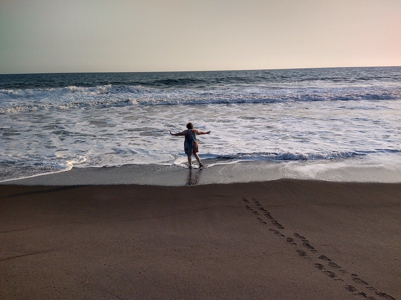
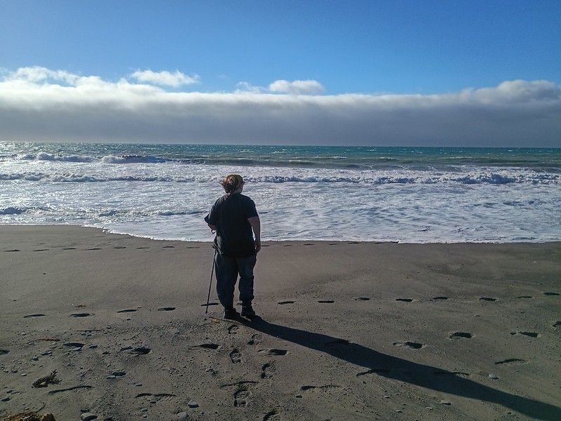
On the left is me at the coast of the Pacific Ocean in Guatemala
in 2024. On the right is me at the Pacific Ocean in California, at
the Lost Coast in 2026. How Stefan got a photo in Guatemala
without trash all about, I do not know.
We went back to our campsite and Stefan took off on his motorcycle
to go up Prosper Ridge Road, which I was not interested in doing.
I spent the time setting up the inside of the tent, preparing
everything to cook later, making sure the tent rain fly was
drying, gathering up some thick bones from the ground to take to
the trash (the bones were either from a long, long dead animal or
a jerk who grilled a lot of beef and threw the bones aside), and
taking notes for the travelogue you are reading now. People in
another campsite started flying a model plane overhead, and after
a while, I heard it crash. It sounded like it was quite near, but
when I went out to look, it turned out to be back on the side of
the mountain, below Prosper Ridge Road - and
it
looked like it was unreachable. And it was a REALLY
expensive plane. Yikes.
Stefan returned and
I
heated up two cans of Campbell's Chunky Soup - our go-to
while camping. I sometimes really cook something, but the reality
is that I don't want to spend a ton of time cooking when I'm
camping. We ate and Stefan noticed that the very delicious Pilsner
he was enjoying was from
Cascade
Lakes Brewing Company, a nonprofit organization! OMG, please
hire me!!!
I cleaned up and packed up the now-clean cookware and other food.
It was a perfect evening as the sun set and twilight came. Stefan
was standing next to the picnic table and I was gabbing, and I
looked down... and there was a large skunk at Stefan's feet,
sniffing about.
We carefully, anxiously fled the camp site. We debated what to do,
and Stefan talked sense over my panic: we needed to not try to
drive it away, because it would likely spray Instead, we needed to
wait the creature out, and when we had the chance, load everything
we could into the panniers on the motorcycles, into the dry bag on
the table, and into the tent. That chance came, and we scrambled,
while the skunk sniffed about in the bushes. Our mission for the
rest of the night was to stay in the tent and not piss the skunk
off. We somehow managed to get everything put away without
incident. I walked to the other end of the campground to the vault
toilets, came back, and we went into the tent to sleep and hope
the skunk didn't spray. Pepé appeared again when we had to go out
to pee again hours later - as I came back from the vault toilets,
there stood Stefan next to the motorcycles, looking anxious. We
had to wait him out again. But we managed to get back in the tent
without incident. Pepé never sprayed and, for that, we are so
grateful. He was utterly human-food adapted - he knew that humans
drop food under and around a picnic table. Remember those animal
bones I had removed earlier, putting them in the trashcans
provided out in the road? Pepé seemed to be looking for them - he
kept sniffing the spot where they had been.
I wrote an email to the BLM office that manages the site after we
were back, to warn about the skunk (I think they should put a sign
up). I made a lot of jokes, and the person who responded made them
right back. Because what else can you do?
And one more thing: that skunk was beautiful. I mean it. It was
gorgeous.
Wednesday, Day 5.
In the morning, the skunk was gone. We had breakfast in peace, at
the picnic table, though I kept looking around for him. But,
clearly, Pepé didn't like daylight.
The campground was never more than half full that night, BTW.
Stefan saw some backpackers at one point - the campground is the
start of a a 25-mile, point-to-point backpacking trail to Black
Sands Beach at Shelter Cove. But they didn't stay. And a pox upon
the jerks who left their trash in the vault toilet. It was too
much to go into the bear proof trash cans, which meant you should,
of course, pack it out. They didn't.
We packed up and headed out. We passed the grange where we had
stayed years earlier during
a
Horizons Unlimited gathering, much father out of town than I
had remembered. Once again, there was road construction, and it
made one hairpin turn particularly difficult.
We saw a large store with no name, but
signs
along the road for garden supplies, camping needs, ice cream and
beer. It turned out to be Etters General Store, also known
as the Etters Family Store, and we were already in Honeydew. The
much better-known Honeydew Country Store is in "downtown"
Honeydew, but this place is terrific too: it's very large and has
a LOT of stuff - including work knee pads! Can you believe it?!? I
was so happy to have some knee protection at last! We chatted up
the cashier, had some cold drinks, a bathroom break and some ice
cream.
Then headed on up the road, into Honeydew proper. If you continue
on Mattole Road, you will get to some really intense hairpin turns
and, eventually, you will get to 101. It's a beautiful, paved but
really intense ride that I did years before, in 2010, on my Honda
Nighthawk. But instead, we made a left at the sign that pointed to
Ettersburg (yes, the Etters Family again), and onto Wilder Ridge
Road - part of the Lost Coast BDR-X.
It became as intense and as scary as I feared it could be, the
kind of riding they don't show in the slick BDR videos on YouTube.
It was taking every ounce of my skill and attention. I did a
hairpin turn, uphill, on gravel, and almost went over. Then later,
I went around a tight uphill gravel turn to the right and took the
turn much, much it much too wide, going far over into the left
part of the road - bad had there been a truck coming (there
wasn't). In fact, I almost went off the road. I managed to stay
on, and I found out later, because I'd done all that, I'd avoided
some dreadful potholes that almost did Stefan in.
I kept going, but I knew I was done with the Lost Coast BDR-X. I
couldn't do it.
The BDR-X continues down Kings Peak Road, but when we came to that
turnoff,
we
instead continued on Wilder Ridge Road, which becomes
Ettersburg Road. Wilder Ridge Road through Ettersburg is not easy.
It's still gravel and it still takes all your concentration with
its slopes and turns. But it's not the BDR-X. It eventually hooks
up with Briceland-Thorn Road, which I think is when our route
became paved, and then brings you to Shelter Cove Road, a
beautifully paved road but which also can be very busy,
the
twisties require ALL of your attention, and there is a
staggering drop through some hairpin turns. It twists down down
down, which means you are going to have to go up up up around
tight corners to leave.
If you can do the official BDR route from Honeydew to Shelter
Cove, the Lost Coast BDR-X is are definitely for YOU, and I doubt
you will have any problem with the rest of it, especially since,
supposedly, this isn't the hardest part. Enjoy.
So some ADV riders will now say, "Oh, I guess you just want
gentle, easy flat straight pavement!" Um... no. There is a LOT in
between gentle, easy flat straight pavement and roads that are
gravel and dirt, with endless, severe uphill and downhill slopes
and hairpin turns, sudden drop offs, rutted roads, missing parts
of the road, huge potholes, massive rocks and no room for any
mistake. And it's that in between that I ride. And what I ride
still makes me an ADV rider.
We stopped briefly at a convenience store just outside of Shelter
Cove because we weren't sure if we were near or even in the town
yet. The guy on the chopper, who was wearing flip flops and is
probably living rather rough, was very sweet and told us we
weren't there yet but that there were lots of food options in
town. Once we got to town, I saw a sign for a deli, and decided to
follow it. The deli is in the Lost Coast Inn, but what's also
there is a pizza place - Delgado's Pizza - and we went there
instead.
We parked, went in, ordered, came back out to sit on a picnic
table, and I teared up. I had failed. That was bad enough, but
now, the supposedly "easy" paved road, Shelter Cove, had pushed me
to the limits of my skills as well. The idea of going back up the
oh-so-steep turns out of town, eventually to 101, didn't help my
shattered confidence. I really needed a calm voice telling me,
"It's okay, you've been riding since 2009, you're a better rider
than you think you are, you've done this kind of road before and
very well, you go up Timber Road at least twice a year, you were
fine coming down here, you are going to be fine going up, just
focus and breathe and you can do this." But I don't have a
personal riding coach to do that.
We ate what turned out to be really delicious pizza, then rode
through this picturesque, isolated coastal town, stopping at
one
of the overlooks to see if there were seals. There weren't.
Shelter Cove is ridiculously beautiful, with many homes tightly
hugging the sharp slopes all around. It looks like it would be a
nice town to stay overnight in. There is a campground, and I guess
they allow tent camping, but there's no privacy - it looks like
just a big field.
We watched a lot of BDR riders coming into town on various
motorcycles, all heading to the more popular part of town to eat.
Part of me was sad to miss talking to other riders - it's
something we very much enjoy. But most of me was glad, because I
would have to tell them, yeah, I tried to do the BDR. I failed. If
you exclude any part of 101 that's considered the Lost Coast BDR
X, then I did less than 100 miles of it on the entire trip. And if
it's one thing I've learned, while most ADV riders are welcoming,
encouraging and nice, there are some of them who look at me with
absolute contempt - I'll never forget the KTM riders in Jarbridge,
Nevada who mocked me for coming into that town the "easy" way
instead of via the extremely hard road they had come in on. Later,
Stefan told me that, in fact, he's not always inclined to talk to
BDR riders - some of them ride because, for them, the point is for
riding to be as absolutely difficult as possible, and if you
aren't doing that, and if you aren't dropping your bike regularly,
they don't believe you should be riding a dual sport at all. I
hope they aren't all like that. But that's just not how we ride.
Up for a challenge to get to a historic town or incredible camp
site? Let's go! But ride a road JUST because it's hard, JUST to
say, "I did that extremely difficult road!"? Pass.
I talked to myself outloud for the entire ride out of Shelter
Cove, saying all the things I thought I needed to hear. And,
indeed, I rode out just fine - perfectly, in fact. Every line was
what it should be, even on the nastiest of uphill right turns.
We continued on Briceland Road, out of the canyon, to the small
town of Redway and then, right next to it, Garberville. We got gas
and realized we had a problem: we didn't know where to go.
You hear a lot of motorcycle riders and other travelers say, "I
don't have plans when I travel. I just go!" This is almost always
entirely BS. People, including motorcycle travelers, have plans.
It could be that there are some things they want to see in a
general area, but no specific itinerary. It could be that they sit
down the night before and map their routes for the next few days,
but no more. And they regularly check the weather, based on those
plans, and are ready to change them as needed. But they do not
just get on a motorcycle and say, "Let's see what happens!" every
morning. Because that leads to massive amounts of wasted
time, going down roads that are not only not interesting but lead
no where and backtracking. Or ending up somewhere in horrible
weather that could have been avoided. Or arriving at a place
that's closed for the season. Or realizing later that the road you
SHOULD have taken but didn't was the one that had the prettiest
views.
We don't plan every day of a trip, usually, but we do have general
ideas. And on this trip, the BDR-X was supposed to provide the
frame for the entire trip. We expected side trips, sure, and
expected to do more than just that route, but now, 500 miles of
our route was off the table.
We headed to the nearby Garberville Redway Area Chamber of
Commerce, also known as the Southern Humboldt Chamber of Commerce
& Visitors Center, hoping they were at least open. The office
was not only open, not only was there a TON of free literature
about the entire area, but there was a super helpful lady who was
THRILLED to help us decide where we should go next. I'm serious.
She was THRILLED to help us. She knew all the roads around, ask
lots of questions and made all sorts of recommendations. By the
time we were done, we had idea! Hurrah for visitors centers!!!
We headed down 101, noting the large former military truck
converted into a camper at the Trees of Mystery parking lot. We
didn't stop - seems a lot to pay, even for terrific trees. We also
passed a roadside attraction, one of those "Believe or Not" sites,
maybe on Confusion Hill, and it looked like the site was not only
closed, but vandalized. I rarely stop at "tourists traps", but I
have done so sometimes, when I'm in no hurry and I'm in the mood
for something quirky. I was really sad to see this. But I couldn't
find any reference to it online.
There were a fair number of motorcycle riders coming at us from
the other direction, or passing us when we stopped. This area
really is motorcycle riding heaven. But we never ended up stopping
in the same place to talk to any.
In Leggett, we turned off onto 271 to go to Leggett Valley Redwood
Mercantile,
to get some things for the evening. I glanced at a young guy on a
bicycle and without really looking at him, returned his greeting -
and about 30 seconds into the conversation realized I was being
hit up for money. This is the second time we've encountered
someone pretending to be a bicycle traveler (the last one was
years ago, in Nevada). Just like that other guy, this one had a
few little bags on his bike, but not much, not enough for a
bicycle traveler. Like the other guy, he was wearing a helmet, but
if you just spent 10 seconds looking him over, you could see none
of his clothes, including his shoes, were appropriate for riding a
bicycle, let alone traveling on one. I felt so stupid. We went
into the store for our stuff, and the cashier, a young woman,
asked if he had bothered us. I said that he had asked for money,
and she said he had been dropped off by a truck about 30 minutes
before (so much for his story about having just ridden Highway 1
from the coast to here) and was sometimes yelling at people as
they passed. I told her to call the non-emergency number for the
police. I don't know if she ever did, but he was starting to get
aggressive with his "HAVE A BLESSED DAY" yelled greetings to
anyone who came into the store.
We headed out on US Highway 1, which would return us to the
Pacific Coast. It was winding and beautiful! But you need to stay
on your toes! How had we never done this road before?! And there
weren't many people on it, which surprised us both. There also
were no campgrounds. That was a shock. We were looking for one,
ready to end our day, but there was nothing. We wound our way down
to the coast, and stopped on the side of the road, agreeing that,
as soon as we saw a campground, we would stop, because it was
almost 6 p.m. It would get dark really soon.
The first campgroud we came to, with gorgeous views of the ocean,
had a sign saying that it had no potable water. And Stefan didn't
like the look of it. At almost the very next turn off was
campground
number two, also part of Westport-Union Landing State Beach,
we learned, and it DID have water. I stayed at the only campsite
that had an unobstructed view of the water, and Stefan rode to the
third campground, not too far further South, and came back to say,
yeah, where we were was the best option.
It turned out to be a MARVELOUS option. We were sandwiched between
two RVs, but we could see the horizon on the water from our tent
door! The bathroom looked like an out house - and turned out to be
a flush toilet (and surreal to sit there and hear the surf
crashing behind you). The other campers, all in RVs, were very
nice, particularly the guy from Scotland, who had come for just
two nights and ended up staying the entire 14 day limit. The only
disappointment was seeing other campers drive in, look around, and
leave, I guess because all the places with an ocean view were
taken. One was a motorcycle traveler - it would have been so great
to talk with him! But he drove in behind Stefan, looked around,
while still on his bike, and left. Another was a van camper - same
thing. I'm sure the van camper wanted our spot. But, truly, we got
the last one at ANY of these campgrounds, and just by sheer luck,
so they totally should have stayed - we would have shared our view
over dinner! Plus, the sites back next to the road would have been
terrific - traffic completely ended in the night. Before traffic
died down, we saw so many motorcycle travelers, most heading
North. Which greatly confused me, as it was getting late, and
other than the one campground we passed, there are NO
accommodations in the direction they were heading for about 30
miles, and that was only after the steep, steep winding, forested
incline they would soon be doing in the dark.
I like to have our camping destination sorted no later than 3 p.m.
We don't have to be there at that time, but by then, I want to
have a solid plan for getting somewhere. Because I will do
anything to avoid riding at night, for fear of deer, elk, other
wildlife, and drunk drivers. But if you DO get to a site that
early, it gives you time to relax, maybe even to get a little hike
in. By the time we had unpacked and set up, it was too late to
hike
down
to the beach, which was quite a schlep.
We heard later that the camp host had had to call authorities for
a couple of very sick seals who, no doubt, how to be put down.
They had been affected by blue-green algae (cyanobacteria), which
can produce dangerous toxins that have killed MANY dogs frolicking
in lakes and creeks. If the seals had encountered such, it means
it's in the ocean too, in or near standing water. It made me so
sad.
The sunset was gorgeous. The moon rise was gorgeous. The sound of
the waves was fantastic. It was our second time camping next to a
shoreline, something we'd never sought out, and it was glorious.
After sun set, in the dark, in came four vehicles, each pulling
trailers. They pulled into the far side of the campground from us,
near the road. Out poured probably 25 people, a mix of adults and
kids, and dogs off-leash. We decided they were a church, maybe a
cult. Of course they let their truck lights shine right into our
campsite - I was about to flip the bird, and just leave that
greeting up until they realized what they were doing, but they
turned them off before I'd had enough. I was bummed about them
primarily because there was only one bathroom, and I hate waiting
for the bathroom (yes, I'm a bad ass motorcycle babe, but I'm also
a 60 year old woman). It's a reminder that how much you do or
don't like a campground can depend entirely on who else is in that
campground.
But they didn't ruin our stay. Between the crash of the waves and
my earplugs, I didn't hear them.
Kudos to the camp host for having a big box of tent stakes right
at the entrance. I don't know if those had been left over the
season or what, but I bet those were VERY appreciated by various
campers.
Thursday, Day 6.
The sun rose, and we dawdled a bit, hoping the rain fly would dry
out a bit more from the dew before we packed it. I couldn't
believe we had camped two nights at the Pacific Coast, with
nothing between us and the surf but either a dune or a cliff. It's
the kind of camping all the influencers long for. I'm no
influencer, however... just a gal out trying to have a nice time,
and writing about it for, mostly, myself.
All of the RVs were packing up - they were moving on as well. The
cult was staying for three days.
We decided not to have much of a breakfast and, instead, to have a
big brunch at a restaurant, hopefully a diner, later.
Highway 1 remained twisting, rising and falling. When it didn't
have beautiful views of the coast, we road through tree-lined
areas lined with ranches and farms. I couldn't believe we were
only now doing Highway 1 in Northern California, after all of
these years. The weather was perfect, and there was more traffic
than I wanted, but it wasn't overwhelming.
I have always wanted to do Highway 1 around the Carmel area, all
the way past Hearst Castle. That area was my favorite to camp in
when I lived in San José, California back in the 1990s - I'd sleep
with my dogs in the back of my truck, before I got a tent. I
realize that, at my age, with lack of funds and vacation time,
we'll never do it. But this part of Highway 1 was a glorious
consolation prize. I'll say it again: skip the Oregon Coast.
Highway 1 in California is a thousand times better and will
fulfill your need of riding the Pacific Coast.
We entered Fort Bragg and I was looking for a breakfast place, and
saw a sign for breakfast.
It
was Cafe 1 and it was wonderful! We split an
omelette that came with hash browns. I left most of the hash
browns for Stefan and got a pancake, which was to die for. The
service was outstanding. Stefan used some of the restaurant's own
sauce that was on the table and it was really, really good - we
didn't buy any, however; it's just so hard to buy stuff and take
it on the bike, especially things made of glass. And we have SO
much hot sauce at home already.
We continued on
beautiful,
twisty Highway 1, enjoying the occasional
tree-lined
parts, and pulled over at some point just for a drink of
water and what not, and when I tried to get back on the highway, I
did something really stupid: I tried to get on from the side,
over
an abrupt edge. I don't know what I was thinking. Had I just
paid better attention, I would have seen that, just a yard away,
the gravel shoulder and the pavement were even. But I tried
instead to do exactly what you are told in any basic motorcycle
course NOT to do. I did get on the highway, but wobbled and fell
almost immediately. There was no traffic coming, because of
construction we'd already passed. I crawled out from my bike,
trying to catch my breath, feel if I was hurt, and get out of the
road. Stefan was asking, "Are you okay? Are you okay?" And I was
having trouble answering. Traffic started coming from the opposite
direction and NO ONE stopped. A guy coming up behind us stopped -
a Latino gentleman in a van. He kept asking, "Are you okay? Are
you okay?" I think he wanted to call 911. I finally caught my
breath and said I was okay. I wasn't entirely sure though - I had
a pain in my side. Stefan pretty much forced a group of Harleys
coming by to stop. The gentlemen in the van got out and helped
Stefan pull the bike back up and park it on the side of the road.
One of they Harley riders asked me if I could take a deep breath,
and I could, no problem. So I knew I didn't have a broken rib.
Everyone eventually moved on and I just stood there, trying to
figure out how I was. I ultimately decided I was okay and could
get back on the bike and ride. And my bike was mostly okay, just
beat
up here and there.
I was so humiliated. A stupid, rookie mistake that could have
ended the trip. And it affected the rest of the trip.
We were already planning on staying at a hotel that night, both in
need of showers and doing some laundry. Now, with my side hurting,
I certainly wasn't keen on sleeping in a tent that night.
As we approached Mendocino, it was all I could do to NOT sing
Mendocino
over our helmet com. For reasons I don't know, it's a German
carnival song, and Stefan HATES carnival songs. Have I mentioned
that I once sat next to Sir Douglas at a party outside of Austin
and was too overwhelmed to try to talk to him?
But
the
ride continued to be wonderful and I wasn't in any pain when
sitting on the bike. At one point, we saw the tops of buildings
that looked Russian and I later learned that we were seeing Fort
Ross State Historic Park, North America's southernmost Russian
colony, founded in 1812, which preserves several original
buildings and has some well-done reconstructions. A shame we
didn't stop: it looked really interesting. Fort Ross was a
thriving Russian-American Company settlement from 1812 to 1841. It
was established as an agricultural base to supply Alaska. It was
the site of California's first windmills and shipbuilding, and
Russian scientists were among the first to record California’s
cultural and natural history.
At Jenner, we at last left Highway 1. I felt sad to leave it, but
we had decided to head all the way across the state and return to
Bodie, one of my very favorite places on Earth. We were following
the suggestion of the lady at the Garberville Redway Area Chamber
of Commerce, headed to Santa Rosa to find a hotel. The ride was
still quite interesting, even beautiful. California is such an
incredible state in its variety of land. Of all of the states in
the Union, I think it truly could be its own country, and you
would never get bored even if you never left it.
Coming in Santa Rosa was disappointing. I thought it would be more
interesting. I found out later that the Charles M. Schulz Museum
is there, and it includes a labyrinth in the shape of Snoopy’s
head. But that would have been only interesting to me - Charlie
Brown doesn't really mean anything to him. We pulled over to find
a hotel, and ended up at the Country Inn on the main drag. It has
simple, clean rooms, a well-monitored parking lot, and a pool! One
caution: look for a deal and do NOT call whatever you find on the
Internet as far as the official reservation service - the price is
almost TWICE as much over what you will find on discount sites.
The owner
opened
the pool for us. They were stunned we wanted to use their
unheated pool, on a cool day, but we did! We had been hot all day,
and we weren't hot anymore, but it just sounded nice to do anyway.
I was hurting, but nothing too bad. I noticed that it hurt mostly
when I walked and when I sat down or got up. I hadn't hurt at all
while riding the motorcycle, but getting on and off was a
challenge. We walked across the street to a fast food burger place
for mediocre burgers and great tunes on the Muzak. It was called
Habit Burger, and it was bizarre, because they really work so that
you have no human interactions whatsoever. You order from a
screen, your number is called when your order is ready, but you
never talk to any human unless they need to bring a special order
to your table.
We went back to the room, rinsed out the laundry in the sink and
hung it up to dry, played on our phones a bit, and then watched
some Jimmy Kimmel and Seth Meyers, the latter of which made me
laugh so hard that it HURT. Literally. I took some ibuprofen and
moaned a few times in the night, every time I tried to turn over
or had to get out of bed. It wasn't great, but I was so grateful
not to be in the tent.
Friday, Day 7.
One of the really nice things about staying in a hotel is how easy
it is to pack up and get going early without even really trying to
do it fast. We weren't packing up sleeping bags or air mattresses,
nor packing up the tent, and that takes more time than you might
think. It's also easy to get dressed sitting in a bed or a chair
than doing it in the tent.
I wanted a nice breakfast, so I looked online and found
Dierk's
Parkside Cafe. It was just what I wanted. I LOVE
DINERS! Good food, great service. I so wish we had a diner in the
town where I lived. A few have tried - they've all been lousy.
A man came into the diner with a little boy, a toddler, who headed
straight for the diner's play area. He was happily playing with
various toys, then looked up and his eyes got twice as big. He was
staring at our helmets. I thought he was going to explode. It
turns out he LOVES motorcycles. It was everything the Dad could do
to keep him from grabbing a helmet after he bolted across the room
to do so.
I had seen something about a
historic
Spanish mission in Sonoma, and I was really in the mood to
SEE something, not just drive by it. We could see it without going
out of our way, so off we went. We pulled into Sonoma, which was
packed with traffic, and eventually came to the town center and
both got flashbacks to Antigua, Guatemala. And several other
Guatemalan cities. Sonoma is laid out exactly the same way as
those cities. We were so charmed. It would have been WONDERFUL to
have spent a night in
downtown
Sonoma and more slowly enjoyed the historic buildings all
around the town square.
We found the free parking in the block next to the mission and
walked over to view the site. I loved it. I loved
how
well preserved it was, I loved how it instantly transported
me back to our visits to missions in and just outside of Loreto,
Mexico and Guatemala,
I
loved the courtyard in particular, and I really appreciated
the
details about the horrific mistreatment of indigenous people
by both the Spanish conquistadors and the Catholic Church - and
not limited to just one panel of info in the corner. "The missions
left a permanent impact on the Californias. The negative and
positive results are evident in all areas of our society.
Regardless of the intent of the missionaries, the results were
devastating to Native Americans." I appreciated seeing both the
beauty and logic of the mission layout and an unvarnished,
truthful, non-romantic account of the European colonization of the
Americas.
Really appreciated the No Kings rally happening in the park as
well.
We headed out of Sonoma and, eventually, through a bit of Napa. It
was disappointing. I have been to Napa twice, both times for an
extraordinary Renaissance faire, in 1990 and 1991. I remember the
area being really beautiful, but this time, I didn't experience
that. It wasn't pretty to me at all. Also, looking at the tourism
guide for the area the night before in the hotel had shown that
Napa is pretty much just for the VERY wealthy.
The landscape started to not be so nice. Beautiful scenery was
gone. This was probably the worst time of the trip, scenery and
traffic wise. At Cordelia, were had to get on I 80 briefly, then
back onto 12, and that, and from there to Rio Vista. It was flat,
it was windy at one point, there were LOTS of cars, the road was
so straight. So, so straight. We stopped at a gas station in Rio
Vista, just before the
Helen
Madere Memorial Bridge over the Sacramento River, and
decided we'd look for a campground on the phone, and even reserve
a site, just to make sure we would have a place, because it was
Friday, and even though we were more than two weeks out of high
season, we were seeing a lot of "campground full" signs. I looked
online farther away than I wanted to ride and found Ironhorse
Campground on New Melones Lake, near Angels Camp. It's part of the
Gl0ry Hole Recreation Area - and, yes, I have altered the word
Glory
because that word, together with
Hole, could get my entire
web page blocked in a search. Tensions were high as we pulled out
of the gas station - we'd had a lousy three or so hours of riding,
and standing in a gas station parking lot arguing over where to
stay the night isn't fun. But that's the reality of motorcycle
travel, the part that a lot of motorcycle travel folks on YouTube
don't even mention: it's not always beautiful.
We stopped at a grocery at Angels Camp and I was so frustrated
with the parking lot, because it was much higher than the road -
meaning that there was a sharp hill to get in or out. I loathe
sharp hills at low speeds. Or having to stop on them. I made it in
and out okay, but it always shakes my confidence for a while.
We
passed another No Kings rally (hurrah!) and went through the
newer part of Angels Camp. I had been there back in 1995 or so,
staying there for a friend's wedding at the former Pioneer Hotel
in Sheep Ranch, California. It's the best wedding I've ever been
to, other than my own, and I will long for the rest of my life to
own a place like it.
A note about Angels Camp: the story goes that, while staying in
the town in the 1800s, Mark Twain heard a local tall tale about a
gambler, a slow mare, a fighting pup, and a trained jumping frog
named Dan'l Webster. He turned that local folklore into the short
story, "The Celebrated Jumping Frog of Calaveras County," which
was published in November 1865 and brought him his first success
as a writer.
We drove through
the
historic part of Angels Camp and I was so charmed by the
19th-century stone and brick buildings. I would LOVED to have
stopped, but sun down was almost here, this area looked packed
with tourists, and we needed to get to the camp ground before
dark.
We found the campground entrance fine, but it's quite a maze
inside, and there are two different campgrounds in this recreation
area. After some confusion, we arrived at our reserved camp site
and were thrilled with what we found:
a
site with a beautiful view, and not too far away, flush
toilets and showers! This place was an unbelievable bargain! We
unpacked and Stefan threw the tent rain fly over a picnic table of
the empty site next door - it was still wet from camping on the
coast. There were campers not too far away but, thankfully, they
were quiet. And a family arrived just at nightfall and, again, we
lucked out: at night, they were quiet.
I love camping, I do. I just often hate other campers. Why do
people bring SPEAKERS to a campground? I don't want to hear your
music. I want to hear the wind in the trees. I want to hear birds.
I want to hear the yaps of coyotes in the night (and I did!). I
don't mind the sounds of people enjoying themselves, but I really
don't need to hear conversations from several yards away.
Stefan stopped a very nice ranger driving by, who looked too young
to drive, to ask him to put a notice on our site that we had paid
online - we wanted to have the site officially.
We enjoyed
the
sunset and
moon
rise. Once again, I thought about how, a few hours earlier,
we had been worried about where we might end up, and here we were,
in a gorgeous, quiet, perfect place. We were having ridiculously
good luck when it came to camping. I thought about all of the
sights we'd seen so far. I thought about how much I used to want
to stay in California for the rest of my life. I thought about how
much I love riding my motorcycle. I thought about how much I love
my travel partner, my life partner.
I wasn't missing the BDR-X at all. But I was missing our dog,
Lucinda. As always.
end part one
Link to
Travelogue Part 2 (final part)
Be sure to view the home page regarding this trip, as it
has a list of everywhere we stayed (camping and the two
hotels), the best places we ate, and some great things we
recommend you visit too on such a trip.