Be sure to start at the home page regarding this motorcycle
adventure, as it has a list of everywhere we stayed
(camping and the two hotels), the best places we ate, and some
great things we recommend you visit too on such a trip.
And, of course, read part 1 first!
Saturday, Day 8.
I was shocked at how well I'd slept in the night, on the ground,
with a sore side. It wasn't easy, I was still moaning from pain
sometimes, and I hated any time I had to get up in the night (and
I'm old, and I have to get up a lot in the night), but I was
getting better, a bit, and I did get a good night of sleep. And I
wasn't feeling humiliated anymore about dropping the bike over
such a stupid mistake.
We stopped a ranger again that day as she was driving by - I don't
remember why - and ended up having a hilarious conversation about
the futility of trying to get good photos of moon rises, sunsets
and sunsets, and how AI was stupid: Stefan had taken a photo of a
nut on the ground to ask what it was, and the AI agent had decided
we were in Africa.
At least half of the time when we had asked AI for advice about
something - a place to buy batteries, a place to tent camp - it
had been wrong. It often provided information that was not at ALL
what we were looking for, or out-and-out inaccurate information.
Just like at home, it proved better to scroll past the AI results
of any Internet search for whatever it was we were looking for,
and scroll past the advertisements, and see what web sites got
suggested. And double check
everything. I so miss the
reliability of the Internet in the late 1990s.
I wanted to get out quickly, because I feared how hot it was going
to get, including in Bodie. I thought if we left early, we could
avoid riding in heat. Also, we had 200 miles to ride that day.
That's over 300 kilometers. And that 200 miles would include going
over the Sierra mountains, and into the I really don't like having
to ride so much in a day. I know a lot of motorcyclists feel that
distance and the heat are no big deal. But having such a distance
to go means not stopping along the way to see anything and rarely
getting off the bike: you have to ride ride ride. So I didn't have
oatmeal - just a peanut butter sandwich and some banana bread I'd
bought earlier. As a result of not wasting any time at all, we
were out by 9 a.m.
It was yet another beautiful day. We wound our way out of the
vast, not-even-half-full campground, and back on to the road,
headed further West. We needed to get to the California portion of
the Great Basin, and that means going over a mountain pass road.
None of the passes going over the Sierras in California are
boring. Each road has dramatic slopes, at least some good views
and at least a few twisting, challenging curves. In my 20s, I
drove over Donner Pass, on US Highway 80, in my Chevy Blazer, from
Kentucky to California, with my Mom and dog. Driven by others in
cars or trucks, I've been over Tioga Pass, Carson Pass and Sonora
Pass, each more than once. But the only pass I've driven over
myself - I'd ridden over it on my motorcycle years ago - was
Ebbetts Pass. I asked to go over Sonora Pass this trip, because
long ago, it had been my favorite. But as we headed through
Strawberry, it suddenly dawned on me that I had never driven nor
ridden over Sonora Pass myself. It's the pass I've been over more
than any other, and I was suddenly remembering some of the sheer
drops on the side of the oh-so-high roads.
It's
a beautiful ride, and I recommend it, but, wow, it's a much
more
challenging road than I remembered: I had forgotten just how
much the road drops and twists
after
the top of the pass itself, for instance. I talked myself
through it, just as I did for the ride up from Shelter Cove days
earlier. As a result of being hyper focused on the road, I missed
the big spot of land I had camped on a lifetime ago, in the 1990s,
and had woken up surrounded by Marines from the nearby Marine
Corps Mountain Warfare Training Center.
We passed a line of port-o-potties in a large area for parking as
we got to the bottom of the mountain and found out later it was
for the Ridge Rambler, a 5K and half marathon run that had
happened earlier in the day - so, so glad we missed it.
Even
when you are off the mountain, the area is still so, so
beautiful.
We passed the marines compound, which was much bigger than I
remembered, though missing some hangers, it seems to m, and headed
straight for US Highway 395, through Bridgeport, and then South
for Bodie State Historic Park, the largest abandoned historic city
- ghost town - in North America.
This was my third visit to Bodie. When I brought Stefan on his
first visit to Bodie, we came to it via a rental car from San
Francisco, over Tiaoga Pass. I think Bodie is mesmerizing, and I
really wanted to see it one more time. I don't know that I will
ever be here again. We started up the road, and I was surprised at
how much of it was paved - I remembered far more of the road as
gravel, and maybe it was once upon a time, but now, just the last
few miles are.
It
makes getting to the town feel a bit more epic. It is
incredible that Bodie is here -
there
is NOTHING all around.
We passed two flocks of sheep in the fields as we headed into the
hills toward the town - there was a time when the shepherds were
from the Basque country, or descended from immigrants from such,
but now I think the the two we saw, living in RVs nearby, are
Latino.
There
are more than 100 houses and businesses still standing in Bodie,
including
a
church, a
school,
a
hotel,
various
stores, various
saloons,
and
so
much more. Original furniture, goods and other items are
left
intact inside the remaining buildings. Mark Twain, when he
was known as Samuel Clemens, lived in and prospected around
Aurora, Nevada, a relatively short distance across the hills from
Bodie, so it's likely he came to Bodie when the town was booming,
though they are 17 miles apart and, even now, Google says a car
would take an hour to do that road. Major fires in 1892 and 1932
destroyed large portions of the town, leaving less than 10%
of the original 2,000 buildings that stood during the height of
the gold rush. The surviving buildings are preserved by California
State Parks in a state of arrested decay, meaning they are
maintained just enough to prevent collapse - the roofs, walls and
foundations are monitored and, sometimes, repaired.
Bodie, California is the town where my love of historic towns was
born, and why I visited, and loved, Custer, Idaho, Garnet,
Montana, and various places in Washington state over the years. I
think about the dreams of the people who lived here, the often
very unromantic lives they lived, the hardships, how much more
precious live music and books were to them than they are to people
now, and I wonder where the people in these towns ended up.
We pulled up to the guard station and the ranger asked, "Are you
staying in Bodie or going through?" I was confused by her question
and replied, "You can't stay in Bodie!" Which is correct: you
cannot camp in Bodie. There are no overnight accommodations except
for the rangers that live there. It turns out that the California
Backcountry Discover Route (BDR) goes by Bodie! I didn't know
that. Sure enough, in the parking lot, we regularly saw
motorcyclists coming over a hill from the North, or heading out
that way from the parking lot. Some stopped at the parking lot for
a break, some rode right on. None stayed to look at the town, and
that made me sad. But that, seems to me, to be what the BDRs are
about: ride ride ride. Push yourself hard. I knew what their
reaction to my abandoning - failing - the California BDR-X would
be so I didn't try to make conversation. I encouraged Stefan to
talk to some nearby, but I didn't want to.
It turned out NOT to be hot, not on the ride from Sonora Pass and
not in Bodie. Apparently, it never really gets hot in Bodie,
because it's so high up. Still, I changed into my light weight
hiking pants in the parking lot and then put my boots back on. I
just did not feel like schlepping through the grounds in my bike
pants. I'm so glad I changed - it made it so much easier to
maneuver. I also assembled my collapsible hiking stick - again,
thank you to my husband for that perfect gift. Walking with a
stick makes me look like the old woman I am, but I don't care: I
don't want to fall.
There are flush toilets in Bodie, by the way, next to the parking
lot. Wear a backpack for your water and any snacks you bring.
I loved being there again. Everyone was taking photos of
EVERYTHING, including us. It was such a gorgeous day, and I think
everyone knew that all of our photos would be amazing. We pushed
our cameras up to the windows for many of our photos, so we could
get interior shots. I find it fascinating to see pool tables,
roulette wheels, a restaurant kitchen, home kitchens, stores,
decaying beds, the hotel's lobby, the school and so many other
buildings all looking like people just left one day and never came
back.
We walked into a structure for just a bit -
a video about
Bodie was starting, narrated by Hoyt Axton! It's available
on YouTube.
We were too late for any tours. That was disappointing. I'd love
to do a guided tour there. Maybe someday? Probably not. I really
do think this was my last visit to Bodie. I have so many other
places I want to see. I'm also 60. And unemployed. Lack of time
and finances is closing in...
I was so focused on not forgetting my water bottle anywhere in
Bodie that I stupidly left my phone in the bathroom. More on that
later.
All
of my photos of Bodie from this trip are in their own photo
album.
We asked a ranger in the gift shop for a recommendation for a
nearby campsite, and he looked dumbfounded, as though no one had
ever asked that question before. We ended up heading to Honeymoon
Flats out on Twin Lakes Road. As we left Bodie,
I
marveled at the landscape yet again. This is such a special
place on our Earth. And I thought again about how lucky I am to
live in a country with so many public lands - so many state and
national parks, state and national forests, Bureau of Land
Management land. It's a model for other countries, truly. It's one
of the things I'm most proud of in the USA.
We went to back through Bridgeport and made a left onto Twin Lakes
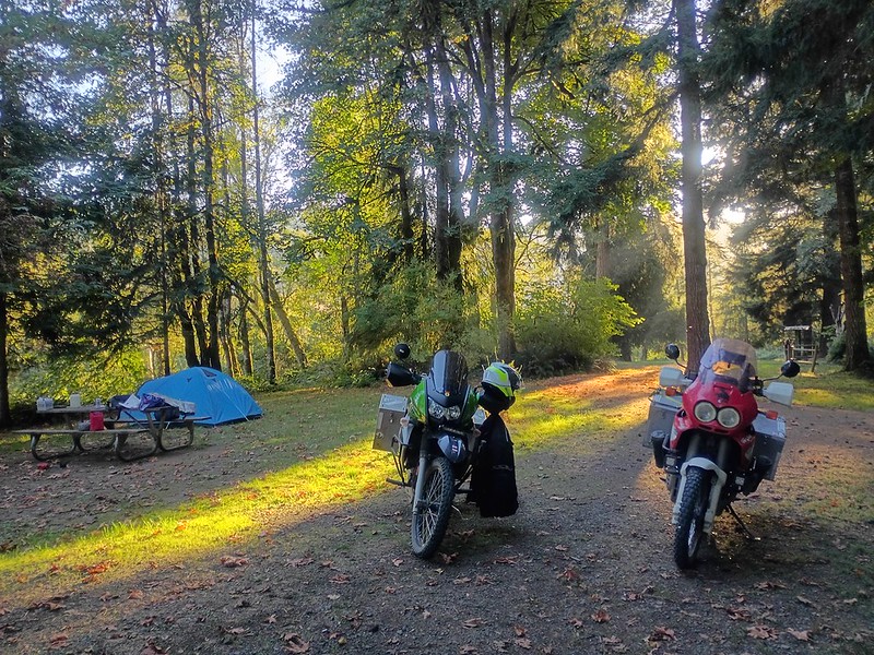
Road. As soon as we arrived at our site at the Honeymoon Flats
campground, I turned to Stefan and said, "We've camped here
before." He didn't believe me. I was right -
we
were at this campground in 2012, but not
this
specific campsite. The camp host told us that they would be
closing this campground the next day - another nearby was already
closed - but another one up the road would remain open until mid
October.
It's really important to remember, when traveling in the USA and
expecting to camp, that public campgrounds start closing in mid
September, more in mid October, and most that have stayed open
that long close in November. It's tough to camp from November 1
through April in the USA - you need a reliable app, you need to
check it regularly, and you need to double check the Interwebs to
know both what options you have and if app info is up-to-date. And
don't think anyone working at a gas station will help: they
usually aren't from the area and have no idea about camping in the
area. If you don't have an app, then let me say it again: check
with the nearest public library.
As we were setting up our campsite, I realized I had left my phone
in the bathroom at Bodie. I almost cried. It was my second big
screw-up of the trip, the first being my fall. And it was too late
to get there before closing and Stefan couldn't get a signal. He
ended up riding out to the road next to our campsite, got a
signal, and was able to call the park. He found out my phone had
already been turned in. We would go back and get it the next day.
But it would be a big pain in the butt - it would not be a "quick
detour" - and it was my fault.
We rode back to Bridgeport for supper. I'm not going to say where,
because it not only was mediocre, but it made us both SO sick in
the night. I was still having major gastro issues because of
medicine I am taking, and this meal did NOT help.
We saw probably half a dozen dual sport motorcycle riders either
passing through town or having a meal. I assumed they were all
doing the BDR, and said so, but Stefan pointed out that dual sport
riders have been touring the USA long before the BDR, and not all
of them ride it. And for some reason, I suddenly stopped feeling
like an ADV Rider imposter. Well, at least for a while. I often
feel like an imposter, about oh so many things.
Anyway...
We got back to the campground and I started setting up the inside
of the tent. I don't recall what I did, but as I was moving things
around inside the tent, reaching for this and that, getting
organized, I turned or reached for something in some funky way and
I felt a rip in my side, where I'd injured myself. I cried out
because it hurt so bad, and then literally cried. I couldn't
believe how bad it hurt. The pain was horrific. I couldn't raise
my right arm at all, the pain was so intense. I hadn't just
re-injured myself, I'd just made it way, way worse.
Had I just ended our trip? We couldn't stay here two nights for me
to recover - the campground would close tomorrow. If I couldn't
ride my motorcycle, how would I get home?
I cried a couple of times in the night, trying to find a position
to lay in where I wasn't almost crying out in pain, trying to just
turn over. And trying to scoot up to the entrance of the tent,
then move to unzip it, then get out, then turn around and bend
over and zip it back up, and on and on... any movement was
excruciating. Added the intestinal issues, and I was pretty much
just wanting to die.
Sunday, Day 9.
Somehow, right after sunrise, after a horrible night of little
sleep, I fell into a deep sleep, in a really awkward position - I
was laying on top of the luggage because it was too painful to try
to get back on my sleeping bag. When I woke a couple of hours
later, I felt a bit better. But it was late. We HAD to leave the
campground by noon - they were literally locking the gate then and
the host was headed back to Arizona.
Stefan said he was going to ride to Bodie for my phone and I
should just hang out at the campsite. So I sat at the picnic
table, drinking water, then some ginger ale, feeling sorry for
myself, taking notes for the travelogue you are reading now and
wondering if I'd even be able to eventually raise my arm enough to
ride.
I knew there was no way we could get out in time if I didn't do
SOMETHING. So, with one arm moving and the other tucked tightly
against my side, I managed to empty our tent of stuff, take down
the tent, and have everything on the picnic table ready to pack up
into our panniers when Stefan came back. I loaded up on Aleve and
finally tried to raise my arm enough to grip both of the handle
bars of my bike from the side - and though it hurt, I could do it.
It meant we could push on. I did not want the rest of the trip to
be just riding back up 395 and getting back to our home in Oregon
as soon as possible. I wanted the trip to continue.
We'd already decided we would stay in Bridgeport that night, if we
could find a hotel room. Before he came back to the campground,
while he had Internet, Stefan booked the Redwood Motel, the best
deal in town.
When he got back, Stefan also said that there were hundreds and
hundreds of Harley Davidson motorcycle riders heading South
through Bridgeport. I thought he was exaggerating but, later,
learned he was right: all of these many, many riders were leaving
the Street Vibrations Fall Rally in Reno. There were still a lot
of Harley riders going through when we returned to Bridgeport,
including a one percenter motorcycle club I'd never heard of
before (and I'm not saying the name here because I value my life).
But even amid the Harleys, we still saw some dual sport riders, on
a variety of motorcycles.
I'd say that, right now, no one motorcycle is dominating the dual
sport rider population. We went through a period where BMW was SO
dominant. And in later years, there's been a lot of KTMs. But it's
such a variety now. I will say that the preferred ADV bikes are
smaller than the ones 10 years ago.
I was disappointed not to see more women motorcycle riders.
There's usually enough to make me feel like we're
well-represented.
Stefan had gotten back to our campground at 11 a.m. and I had
already guessed why it took so long: he'd done part of the BDR
from Bridgeport into Bodie and he also needed to take time to book
a hotel when he had Internet access. But there was even more added
time because he got to Bodie right at 10 a.m., as their morning
"talk" was starting, and there was no one to fetch my phone from
wherever they had it until the talk was over. Because I'd managed
to get everything ready to be packed at the campground over that
three or more hours, we made it out, literally, with just a few
minutes to spare. It had taken some effort to get onto the bike,
but I'd made it, and once on, I was mostly okay, but turning the
handlebars didn't feel great. I couldn't believe how much worse I
felt versus right after my motorcycle accident, or even the day
after the accident.
We couldn't check into the hotel yet - Stefan had booked online
because, when he stopped by, they had a sign up on the door that
said they weren't available until 3 p.m. and you should book
online. So we parked in downtown Bridgeport, split a meal at the
historic Bridgeport Hotel and walked around the historic town. It
was a lovely day and walking didn't hurt me too much.
The
Bridgeport historic court house and grounds are lovely, and
it's all featured prominently in a Robert Mitchum movie. There is
a
historic jail behind the courthouse that you can go into,
and it was still used well into the 1960s! I had been to
Bridgeport back in 1995 or so: I'd seen their 4th of July parade
and then had pancakes at a community event near the court house.
The history museum was closed, unfortunately. We went back to the
main street in town, seeing even more Harleys coming through,
heading South, and found that the little market in town on the
main drag had a place for patrons to just sit and relax and enjoy
free Internet - which we did.
It was about 2:45 in the afternoon when we went back to the
Redwood Motel. It still wasn't open, but there was a place to sit
outside, which we did. Eventually, the owner showed up and we got
checked in.
It's exactly the kind of motel I love: affordable, small, simple,
clean rooms with a comfy bed, a coffee pot, a microwave, a fridge
and a TV. And it's biker friendly. He let us
park
parallel right in front of our room.
Stefan had to unload the bikes - I couldn't lift anything. If I
moved the wrong way, waves of pain shot through my side. I was
still hurting so much more than even the day of my motorcycle
accident. I had seriously strained SOMETHING. Walking was okay.
Sitting on the bike was fine. But getting on and off the bike, or
even just getting up and down from a seat, was excruciating.
But I was hungry! So we walked to Rhino Bar & Grill for pizza.
We'd been splitting some meals, because both of us are trying to
lose weight, and it was working out really well, but this place
had 10" pizzas and we were HUNGRY. The pizza was delicious and the
beer was good. I people-watched most of the time. A group of young
men stood up after the meal and one of them called to the waiter,
saying, "I'll pay for all this when my parents are back in town,
okay?" And the water said OK. Ah, small towns...
We walked back to the hotel and though the hot shower felt really
good on my side, I had a really rough night - I could not turn
over nor get out of bed without stifling a moan of pain. Just like
the day of the accident, I could breathe just fine, including very
deeply. But reach for something with my left arm? Or pick
something up? Or try to turn over in bed? It brought tears to my
eyes.
Monday, Day 10.
I was not as well rested as I wanted to be, and I was in pain but
trying to hide it. I was so, so tired of hurting. At least I knew
that, once I got on the motorcycle, I wouldn't be hurting. Weird,
right?
We woke up to a drastic change in weather. It had rained in the
night and was threatening more. It was snowing to the North and,
to me, it looked like to the South too. We'd had amazing weather
up to this point. Putting on my rain gear over my bike clothes
sounded miserable, a task specifically designed to torture my
sore, strained muscle. I decided to chance it and not put it on.
We walked further downtown to the Bridgeport Inn and had an
amazing breakfast - this time, again, we didn't share. The coffee
and food were wonderful, as was the waitress who remembered us
from the day before.
We
took some photos of the inside - you know how I love
historic hotels!
It felt like the town was closing for the season, not just our
campground from the day before. Would everything open now be open
next weekend, or is this it? And what do people here do in the off
season? And how often are they snowed in?
We walked back to the hotel and Stefan had to load up both bikes -
I couldn't help at all. Then we headed South. I was not quite
mentally in the game and had one of those
I-don't-know-how-to-ride-a-motorcycle moments, but recovered by
the time
we
wound our way down to the turnoff before Mono Lake. We'd
decided not to go to Mono Lake because we'd been before, and we'd
never taken this particular road that runs along the North of the
lake before:
167,
Pole Line Road, which becomes 359 at the Nevada border.
Straight, yes, but the landscape was so beautiful, and I was
grateful that, despite the warning of "gusting winds", and despite
the
thick
snow clouds to the left of us, there was little wind. Before
we got to Hawthorne, Nevada, I saw a sign for something I had
always heard about: the road to Bodie from the "back" way. That
must be QUITE a road.
We've been to Hawthorne, Nevada before, at least twice before for
both of us. We stopped for a bathroom break at a fast food place
and some water, then headed North on US 95. It's a strange area to
me. Lots of military stuff, lots of bunkers. And
Walker
Lake, which seems to be quite the recreational point in
season, but doesn't really look all that pretty. We weren't
entirely sure where we were going that day, ultimately. We weren't
sure what our destination was. Maybe head towards Crane Hot
Springs and camp somewhere and get there the next day? But where
would we camp between there and here? We just kept heading North,
hoping we'd figure it out.
This whole area - Northern California from Bishop to Bridgeport,
and Nevada from here to Tonopah - is significant in my soul. The
landscape changed me. In fact, I went through a time in my life
where I wanted to give up everything and just move out here and
do... something. I'm not sure what. Just live a very simple, quiet
life where I wasn't babbling all the time, where I just looked at
beautiful landscapes and repaired fences or something. It's all so
unworldly out here and, yet, I feel really comfortable here. I've
long ago moved on from wanting to live in the area - I have no
desire to live out there anymore. And, in fact, I think it's
probably the last time I will ever be in that area. But it's just
always going to be special to me - it's why, when Stefan came to
the USA for the first time, this is where I brought him.
Saw signs for mountain goats, but didn't see any mountain goats,
which disappointed me. I'm not sure I've ever seen the mountain
goats out there.
We turned left in Schurz and
stopped
in Yerington at the county library, which was closed, but
like so many public libraries in the USA, staff had posted the
Wi-Fi network name and password on the door! So we sad on the
bench in the shade of the entrance and did some research - and
didn't come up with much. Where would we camp? I just kept
thinking we'd see a campground when we needed to, so we pushed on.
We passed
an
ornate, out-of-place estate that had a sign out front
proclaiming "Masini Ranch." It looked like some kind of
casino or something that someone would build if they suddenly came
into a LOT of money. It is, in fact, private property and the
original owner was Lawrence Masini (1930–2005) who was, indeed,
the owner of a casino in Yerington. His father came to the USA
from Italy in 1907. There are a lot of photos of Masini Ranch or
Masini Castle online.
Eventually, we were on Nevada state road 447. On a map, this looks
so boring. But I think it's fascinating. I don't know how to
describe the landscape. It's high desert,
with
flat basins, but then there are these random rock formations
here and there that look like the ruins of temples. We were
here many years before, in very smokey weather, so this time, it
felt so, so different and much more beautiful. There is nothing on
this road: no stores, no houses, no barns, and no campgrounds. We
saw a spot for rough camping, next to several rock formations in
the middle of an empty basin, but it was much too early to stop,
we also could easily be seen from the road, something we don't
like, there were no trees or shrubs at all, and I was sure it was
a popular rough camping spot, which means a lot of human waste. We
had stopped for gas earlier and I had looked for a place to camp
on Hip Camp, and it was all a joke: people wanted to charge for
camping on their "homestead", but provide no toilet.
We arrived in Empire, a town that is, primarily, a mining
operation, and I was convinced the store was closed - there's no
sign out front anymore, and there's a bit of dusty junk outside
near the door. But we walked inside to a clean, well-lit, well
stocked store. Not sure what's up with the outside appearance. We
bought some things and asked the cashier about places to camp. She
and the two customers said, "It's all BLM land! Camp anywhere!" I
said, yes, true, it's all Bureau of Land Management land, but we
had seen fences all along the road to here, and no gates in the
fences. It all looked off-limits. They confirmed, yes, the land
right next to the road to Empire was mostly private, but after
Gerlach, it would open up. But they said there were no designated
campgrounds. None. I was shocked. I'm still shocked.
The Empire crew also said that there is a place where locals go to
fish and camp and we could go there, it wasn't far. The cashier
gave us precise directions to find it. It was exactly where she
said it was! I couldn't believe we found it truly in the middle of
no where: no signs, and landmarks that all could be described the
same way. But I'm not going to say here where it was. I'm not
trying to be mean - I just don't feel like locals would appreciate
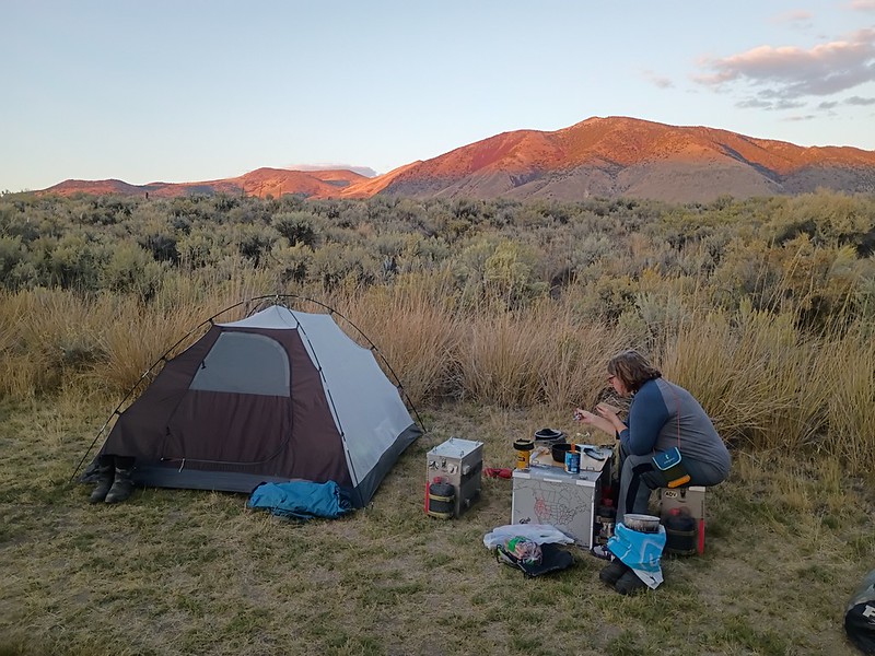
that. But it was perfect: you couldn't
see
us from the road unless you knew exactly where to look amid
the brush and trees, we were behind a fence and a gate, we had
some wind protection and had plenty of privacy. We also had our
panniers, which become our table and chairs in such situations. We
had already picked up supplies, so we had plenty to eat and drink.
We walked around the area, admiring the incredibly beautiful,
empty lands around us, and the surprisingly large,
beautiful
water feature nearby. Stefan pointed out that all of our
rough camping experiences in Nevada had always been fantastic. We
are three for three. And for all of them,
our
motorcycle panniers have been our chairs and table.
Once again, however, the moon was way too bright to see the starry
night we really longed for. And once again, I had a painful night
of intermittent sleep.
I do want to note that there IS a commercial place to stay in this
area:
Bruno's
Country Club and Motel in Gerlach. It's a proper motel - the
photos online of the rooms show that they're absolutely fine. In
fact, the breakfast photos look scrumptious. As long as they have
staff, they open. But we really wanted to camp.
BLM, please open a campground out here, with at least a vault
toilet. In fact, I bet the people of Gerlach and Empire would
really appreciate a public vault toilet near the road in Empire,
like you have for the public in Fields, Oregon.
Tuesday, Day 11.
Despite the pain in my side and waking up every two hours, I did
get enough sleep. We were going to bed with the sun, and getting
up with her as well, meaning we were in the tent for almost 12
hours, and even with waking up frequently, that's a great amount
of sleep. I was never tired during the day.
Traffic had completely stopped with nightfall and hadn't picked up
by the time we had packed up and started off for the day, because
wherever traffic would be coming from was far, far away in both
directions. Stefan warned that we were probably going to go on
reserve before we got to a gas station and might even have to pull
over and put in our extra gas to make it to the next gas station.
That rarely happens to us. I really can't emphasize enough just
how remote this area is.
And, yes, if you haven't guessed yet, this is the road you take to
get to Burning Man. I don't even want to think about the massive
amounts of traffic that produces. let alone human waste. We passed
three or four abandoned, vandalized RVs on the side of the road as
we headed towards California - my guess is that they had been on
their way to or from Burning Man and didn't make it.
As I noted earlier, I had suggested we head for Crane Hot Springs.
I had no other suggestions. I didn't want to get home early, but I
was also couldn't think of anywhere to go that we hadn't been to
before more than once.
As soon as we got to the border with California, the landscaped
changed, with many more trees and greenery, and there were people.
Not a lot of people but, still - there were settlements. We went
through Eagleville and I said what I probably said all those years
before when we were there: this is where I want my friends'
commune. This is where we'll all move and live and retire. We'll
buy all the historic buildings and houses and this shall be where
we live our final days. I will run a small hotel and/or
campground. I need someone to run a small diner for breakfast and
lunch, and someone to run a bar for lunch and supper. We also need
a small market.
I'm somewhat kidding. Somewhat.
We headed on to Cedarville, another small historic town, somewhat
bigger than Eagleville. We stopped at the market, staffed by a guy
who obviously hates working there and living there, and then sat
outside on a bench, marveling at the Cedarville practice of
pulling up to the store or the post office and leaving your car or
truck running while you go inside. EVERYONE DID THIS. It was
bizarre. Fun fact: Letting your car run uses more gas than
starting it if you are idling for more than about 10 seconds.
Idling your vehicle is also loud and stupid.
The
building that housed the Cedarville post office was clearly
built as something else, and luckily,
the
town librarian was walking by and gave me all the details:
it's a former Order of the Eastern Star building. My
great-grandmother was very high up in the Eastern Star, which is
how I know what it is. I think it's so wild that so many social
clubs and religious groups used to have the funds to build their
own buildings. And I love to look for these buildings in small
towns: buildings built by the Masons, or the Elks, or the
Optimists, or whatever. Just look up at the top of an
interesting-looking building that you suspect is old and you can
usually see the name carved into the masonry.
We walked around just a bit and discovered
a
wooden sidewalk in Cedarville, across the street from the
store. I'd never seen one before, except in movies. And also
nearby was a quaint-looking house that hosts
Warner
Mountain Weavers, I looked it up online, and the newsletter
says they had a potluck this summer. Check out how it's described:
It's BRING YOUR OWN BAG LUNCH this month (June). I have a
couple bottles of champagne, and I'll make a cake to share, but
you just do you and come be a part of the fun with whatever you
are working on! July's potluck will be back to our regular
share, so use all of this lead up time to come up with something
super tasty!
I think I need to move to Cedarville and learn to weave.
We mounted up and headed out and, after some confusion, found the
gas station on the edge of town with its super friendly cashier (I
just love those!). In the bathroom, like so many places, there was
a sign offering help to people who are being trafficked. Unlike
others, it included a number for ICE. I'm so glad someone
scribbled that out and wrote "No!!!" above that name and number,
because if you are being trafficked, you should NOT call ICE.
Ever.
We had seen a sign in the middle of nowhere back in Nevada for a
hot springs in Surprise Valley, and so I was kind of looking for
it, but somehow, I missed it. I wasn't even sure what I was
looking for. I found out later it's a hotel. I saw another sign
for it once we were back on 395 and mistakenly believed the road
it was next to would take us there, that it was the driveway for
it, but we realized, no, it was a random advertisement for it. On
this really hot day, I wasn't really wanting to sit in hot water.
I just wanted something to DO. Somewhere pretty. I wanted a break
from riding. I wanted to be in a beautiful or really interesting
place for a few hours. I love motorcycle travel, but I need a
break sometimes. And I don't like riding just to ride - I need a
destination or discovery.
We were back in Oregon, and we stopped in Lakeview, both of us
super grumpy and overheated. We went into Safeway and while we
were talking about Crane Hot Springs and Stefan was telling me it
was really too far to shoot for, a guy stocking the yogurt shelf
turned and said, "Have you heard of
Summer Lake Hot
Springs?"
We had not. He gave us an enthusiastic endorsement and all the
directions and it sounded like a perfect alternative. He'd been to
Crane Hot Springs, and said it was very different, but just as
good. We loaded up on food and drinks and we were off.
We've been on state road 31 going through Paisley before - the
last time, the road was covered in grasshoppers, and as I drove
over them, they swarmed all over Stefan, who usually rides behind
me. By the time we arrived at the restaurant in Paisley on that
trip, he and his bike were covered in bugs.
We know we've been by
Summer Lake Hot
Springs before, but never noticed the sign for hot springs,
camping or cabins. In fact, the signage isn't great at all. But
from what we've learned, it's not needed: the site is well known
enough that they have a steady business, and the web site even
says you really should make reservations. The cabins, from the
outside and and online, look lovely, and they are surprisingly
affordable, but require a two-night stay minimum, you have to
bring your own bedding, and you MUST book them online WELL in
advance. The little office at the "resort" doesn't seem to have
anything at all to do with booking the cabins, in fact - they just
know they have to be booked online and that they are full.
There are no designated camping spots - just
two
big flat areas where there are a few picnic tables (they
really, really need more) and you pick your camping spot. It's a
bit sandy, so if you are on a motorcycle, be careful. There are
also a few fire pits, but not many, certanly not enough for
everyone camping there, usually. There were only nine or 10 other
people camping in various vehicles, and we were spread out enough
to not bother each other, which, from what I'm understanding from
reading online, is rare.
We snagged one of the last available picnic tables (and to
be clear, would have been happy to share it). It's $55 a night to
camp, but given the condition of the hot springs, the flush
toilets in the bath house, the plethora of well-maintained
port-a-potties, and the location with its quiet and beautiful
scenery, we thought it was absolutely worth that price. We were
lucky to be there on the day we were: it's actually fairly common
for an entire part of the campground, or even the entire site, to
be completely booked out with a private event, or just full with a
lot of people who love this place.
We changed out of our motorcycle clothes and walked around the
grounds. Neither of us was anxious to get into the hot water yet,
because it was quite hot outside. There's
a
barn behind the office cabin and we went inside to get out
of the burning sun. A woman showed up soon afterwards and told
Stefan he couldn't be in a part of the barn where he was - there
was nothing at all that said that part was off-limits, there was
no door, and everything was wide open. He promptly left the area
and came back out to where I was, and she had to say, half a dozen
times more, that the area where he was was off-limits to guests.
She just kept saying it over and over, in a different way, and I
almost said, "That's ENOUGH. Stop it. We get it." But I held my
tongue. I asked if we could sit in the barn for a bit in the
shade, because we really needed out of the heat, and she said yes
- and then reiterated at least twice more that we couldn't go into
the restricted part of the barn. Sigh.
I want a barn like that so much though - a place where we could
have gatherings, maybe even live music. There were couches and
even a couple of beds all over, and the woman there said that they
let "burners" on their way to or from Burning Man to sleep there.
"They're all over the place for Burning Man!" Glad we missed them.
But the barn looked great - it even had a small disco ball.
It felt like it was just about to start cooling off, so we decided
to try out the hot spring pool.
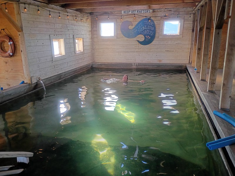
The
historic bathhouse with its 15’ x 30’ concrete pool was
built in 1928, and it has plenty of changing rooms on either side
of the pool. There's also showers - always shower before you get
into a hot spring or pool, please. The area has been used for over
14,000 years! Online sources say the hot water rises from a deep
one-mile underground aquifer along the active Slide Mountain
fault, and emerges at natural temperatures between 113°F and
124°F. The historic bathhouse is absolutely magical, and there are
three outdoor mineral pools behind the house, much hotter than the
indoor water.
We changed into our bathing suits and I got to wear my little
UNICEF dress I love so much over my suit on the walk to and from
the bath house - I always hope I get to wear it on a trip and I
was, at last.
The water felt FANTASTIC, even better than I imagined.
We
usually had the whole building to ourselves, and when we
didn't, the two or three other swimmers were quiet or spoke in
hushed tones, as one should in such a beautiful, tranquil place.
If I won the lottery, I would absolutely have this. And the barn.
We tried out the hotter pools outside. The hottest was too hot for
Stefan. I was just hoping it was all helping my injury.
Then we decided to go to Paisley for food. We went two-up on
Stefan's bike, seeing a para glider, powered with a fan engine,
sailing near the mountains nearby. But sadly, the restaurant was
closed. Luckily, we had the food we'd bought in Lakeview and could
throw something together for supper. Plus, I had enough wine to
get us through the evening.
The
sunset was beautiful. Deserts are so amazing.
I was trying to wait as late as possible to go back to the hot
springs. It's clothing optional starting at 9, and while I am not
fond of people seeing me nekkid, and I'm not really fond of
looking at nekkid people, I do love how water feels when I'm
nekkid! But by 8, I knew I couldn't make it, and if I was going to
soak again, I needed to go then. We had a lovely second swim, and
then went out back for a hot soak, disturbing a couple who seems
to have forgotten this was a COMMUNAL space, and that nekkid time
wasn't for another hour, and that, indeed, there are OTHER PEOPLE
here. They awkwardly blabbled for about 20 minutes, wondering how
much we'd seen of their antics, and when another soaker showed up,
they finally left. And not just the water - they pack up and left
the entire campground in the dark!
As usual, we were in our sleeping bags by 9:30.
Wednesday, Day 12.
We woke up to another beautiful day! This would not be a good
place in the rain - the campground would become soup.
We had some breakfast and, at last, got to talk to the guy camping
near us in a van, pulling a trailer, with two bicycles, a Yamaha
XT250 (which I rode in Guatemala and I still long for) and a
Kawasaki KLX 300. The Yamaha is his wife's, but she wasn't there -
it was very confusing. I had tried to make eye contact with him
the previous evening, because I was sure he would be great to talk
to, and for the brief time we talked, he was! But we couldn't talk
long - we were leaving and he was off to ride some dirt roads.
We went for another soak, our third of the visit, and then took
down the tent and packed up. I don't recall hurting any more than
the day before doing all of that, but when I tried to get on my
motorcycle, I groaned aloud. I was so stiff and moving my right
arm to the handle bars to get onto the bike hurt like HELL. It was
the hardest time I had on the whole trip to get on the bike. Every
bump on the road hurt. I was stunned. This was the worst I had
hurt actually ON the motorcycle, and I couldn't figure out why.
I'd moved in the warm waters of the hot spring pool perfectly
fine, and hadn't felt any more pain that morning than any other
day - in fact, I thought I was feeling better. I just could not
understand why I had had such a setback after being in all that
hot water. Had I moved too much? All I can think is that, in
picking up items and moving them from the tent to the table, and
then the table to the motorcycle, I'd re-strained something. Damn
it.
It would seem logical, from this point, that we would head to Fort
Rock, but we'd visited before, and been by at least another two
times. So we didn't go again. But if you are in the area, you HAVE
to go. It's amazing.
We also didn't want to get home before Friday. Stefan had showed
me the paper map he had that morning and I had picked a road that
would take us on a huge detour: County Highway 2-08. It had
campgrounds on it and, hey, it's called a "county road", not a
forest road, so I figured I could do it.
It
was paved for the entire way up into the mountains, and
there was just a truck here and there. It later becomes National
Forest Road 330 (NF-330).
The
landscape was beautiful - not picture perfect, but empty of
everything but trees and, sometimes, cows. I suspect the
campgrounds we passed are VERY popular with locals. And you get
more altitude that you might expect. I was enjoying the ride for
the most part, but not bumps: any bump hurt my side. A lot.
And let me say it again, as I do in almost every travelogue: all
you men who shoot up road signs are jerks. You're assh0les. You
represent the worst of this country. You should lose your license
to own a gun for the rest of your life. And I guarantee it: you're
all Trump supporters.
Anyway...
I'm not sure when it happened, but we were, eventually and as
planned, on National Forest Road 28 (NF-28) and it became one of
the worst roads I have
ever been on. It was paved LONG
ago, but now there were just patches of pavement, and in some
places, it wasn't just a patch of road that was gone, with sharp,
abrupt edges around the little bit of pavement still there: there
were deep, trip-ending potholes where the road used to be. At one
point, I went to the middle of the road - I don't know why - and
I'm so glad I did, because where I had been, off to the right, the
road was suddenly gone and there was as drop of more than a foot.
In one place, I just don't see how a car would have gone through -
the usable road was just a two feet wide, with severe, sharp edges
and massive holes on either side where the road used to be. We
were both miserable, afraid that our bikes were going to be
pummeled and we'd end up with flat tires or worse. And I was still
in pain, so every bump felt like torture.
None
of our pictures show how horrible this road was. We would
have rather been on flat gravel and dirt! Partial pavement is The
Worst.
But at last, the dreadful, horrible NF-28 suddenly became E Bay
Road and much, much better. In fact, almost instantly, we started
to see large RVs in rough camping spots along the road, and men in
camouflage clothes walking around. It seems hunting season was
starting.
As we neared the barely-a-town of Silver Lake, we saw a sign for
the
Cowboy
Dinner Tree. A guy in Lakeview, Oregon had pushed us REALLY
hard to go there. He had told us about their massively huge steaks
and chicken dinners - the only two things on the menu - but he
hadn't told us the opening hours, nor that it was cash only and
reservations were required. Glad we didn't try to go! I'm sure my
motorcycle, covered in left-wing-themed stickers on the panniers,
would have not gone over well with other patrons.
Advice if you need food of any kind in Silver Lake, Oregon: go the
market at the gas station. No where else. Trust me. In a parking
lot of where we did go (which has
a
place to tie up your horse while you go inside, I struck up
a conversation with a guy who had a Honda Trail 125 on the back of
his rig. I thought it was cute and said so, but he greatly
misinterpreted my enthusiasm for his little bike and started
talking about all his fantastic, brand new camping equipment. Each
and every item. Plus his BMW motorcycle at home, a photo of which
he showed me, acting like it must be the first one I'd ever seen.
I could feel my eyes glaze over. I was afraid he wouldn't stop
talking. He finally left.
We went a bit more north and turned left onto Bear Flat Road,
which is also Silver Lake Road. We got a scare over
a
huge plume of smoke we saw in the not-to-far distance, in
the direction we were going, but it turned out to be a controlled
burn and not very near where we were going: Jackson Creek
Campground.
The campground is not at all easy to find: the sign for it from
the main road is tiny, and while the red dirt road to it is easy
to ride (though I wasn't enjoying it, with my side hurting so
much), there's no sign for the campground until you make the left
for the campground down another dirt road - and you just have to
know that THAT is the dirt road to take - and
you
won't see the sign until you are well down that turn off. We
found the campground only by accident, but not before, as we were
headed down the dirt road, we met the very talkative guy with the
little Honda, heading in the opposite direction in his truck. All
that shiny, new equipment, but he had forgotten his propane tank.
So he was headed home.
We had the entire campground to ourselves! And we felt more
isolated than we had on the entire trip. It's a bit disconcerting,
in fact, to be THAT alone. No one would hear either of us scream.
Yikes. Stefan, as usual, picked out
the
best spot for us to set up camp. Once again,
no
fires were allowed, which was a particular shame since, for
reasons we did not know, almost every campground had
enough
cut wood stacked and ready to use to get through winter!
Why? Is it for the snow mobilizers that camp there in the winter?
The campground has THREE very well-maintained pit toilets. Our
campsite was near the babbling creek. We knew it was going to be a
cold night, but probably not freezing. We have gear for freezing
temps, but anything below freezing is rought - we're fine in our
sleeping bags and winter gear, but you do have to get out of your
sleeping bags in the night at a least a few times, and the morning
is SO COLD and there's no way to get warm as you pack up to leave.
It was such a shame not to be able to have a fire, but when it
says "no fires", we follow the rules.
We did a short hike all around the campground, which is really
big!, and then had a beautiful, very quiet night sitting out on
the picnic table, and then to sleep. I couldn't believe our luck
at being at this campground.
Thursday, Day 13.
The next day, my side felt felt much better. We decided to skip
breakfast and coffee and instead pack up and head out and find a
place for a nice breakfast or brunch and coffee. As we slowly
moved about, I saw a truck coming.
Oh. No.
It was talky guy.
He pulled up
into our camp site - yes, really, almost
right up to the picnic table - got out of his rig and said, "Well,
you took my campsite!" He went on and on about how that was the
campsite he'd picked the day before, how it was the best one
because it was
near
the creek, which is perfect for his outdoor shower, and on
and on. I was so mad I just turned around and started slowly
packing. At one point, I needed to change into my bike clothes. I
really prefer doing that sitting out at a picnic table - it's so
much easier than trying to do in the tent, and trying to do that
would, for sure, re-injure my side. So I just took my hiking pants
and long johns off right there in front of him while he rattled on
and on. I think he realized he was being an ass at last: he walked
back to his truck, unpacked a few things which he started putting
around the campsite, and then went on a ride on his Honda. But he
was back before we were finished... rattling on and on...
At last, we were packed up and gone.
Once we got back to the main road, we headed West, passing through
the Klamath Marsh National Wildlife Refuge. We saw a sign for a
visitor's center, but online reviews later says it's not a
building, just a picnic area, with no vault toilet or water. It's
a very straight road, through a marsh, and apparently it's a great
place for bird watching.
We got to US Highway 97 and turned right, to head North. It's not
a great road: it's straight and really busy. Almost as soon as we
pulled onto the road, we saw
Sand
Creek Station on the right, and I don't know why I pulled
over - it didn't look like it would have food but, but I just
thought I'd take a surprise. WHAT A SURPRISE. It's
a
tiny, very well-stocked store and they do have hot food
inside. Including breakfast! OMG, it was so good. We were so
stunned - it was so unexpected. The guy working the counter says
they have karaoke once a month, and he started describing it - the
vibe, the lights in the trees - and it sounded ridiculous and
AWESOME. They have camping out back, mostly RVs. I'm not sure I'd
tent camp there unless I had no other choice: the noise from the
highway never dies down.
I had proposed for our last night out we go back to where we
began: back to Harlan and Big Elk Campground. But not going back
on Mary's Peak Road down to Harlan.
First, we turned left on State Road 58 to go through Oakridge, a
route we have taken SO many times, but I always love it. In fact,
we'd just been there, going in the other direction, in June, for
our first ever, magical visit to Oregon Shakespeare in Ashland. In
Oakridge, we stopped at Dairy Queen - I was in the mood for a DQ
burger and a Blizzard. I was still on vacation! And as we neared
Eugene, and passed Dexter Lake, I heard in my head, for the
millionth time, lines from
Animal House.
We had to get on I 5, for just a bit - yuck - and then on the
dreadful 99, to Junction City, so we could get onto 99W, which
isn't a great road, but is way better than I 5. Then in Philomath,
we turned left on US Highway 20 - for the second time on this
trip, going in the other direction - and making a left onto Burnt
Woods Harlan Road. I had not remembered the road being SO TWISTY.
That threw me mentally somewhat. We got to Big Elk Campground and
saw that the campsite we'd gotten before was taken by three
vehicles - it was clearly people who are homeless. We went to the
other end of the campground, to the area where the fisher folk had
been two weeks ago, and set up there. Later, a woman and, even
later, a man showed up to camp near the vaulted toilets. We think
they were homeless too.
Before I moved to Germany in 2001, I camped somewhat frequently,
and only once do I recall seeing people who I knew were homeless.
Now, it's unusual not to see at least one site occupied by someone
living out of their car or RV. I always wonder if they are getting
any help at all to find a more permanent situation. Such campers
have rarely hit us up for anything, which we've appreciated. Also,
I'm now older than most of the homeless people we see.
Another perfect night.
Another
beautiful sunset. But it was a chilly, quiet, wet night -
wet from the low clouds coming in from the coast. We would have a
wet rain fly in the morning.
Friday, Day 14.
We did not hear nearly as many cows calling in the night as we did
two weeks before. I think the moos from two weeks ago scared
Stefan. They were, indeed, REALLY loud.
Once again, the morning was clear and we could see low clouds
floating through the valley. We ate some breakfast and then packed
up for the last time and headed back up the twisty road. I was
worried that one of the locals would be hurling down the curves in
a big truck, crossing the middle line, which they are pretty
notorious for doing, but it was still morning and the road wasn't
too busy.
I think we absolutely will visit Harlan again, BTW. If the road
wasn't so steep and our car wasn't so tiny, I'd suggest we come in
our camping trailer.
We turned onto US Highway 20 yet again on this trip, going East
for just a bit, and then turning off onto State Road 223, which is
beautiful and we've taken a few time before in either direction,
including with the camping trailer. If you are on it, be sure to
stop at the covered bridge.
We had lunch in Dallas. We wanted burgers, but settled for pizza.
It's a cute little town. But I always wonder, as I do in towns
like this, what people do there, as in, where do they work? How do
they make money to live?
Going through the tiny town of Rickreall, because we have helmet
coms, Stefan had to listen to me, yet again, sing, "Never gonna
give you up! Never gonna let you down! Never gonna run around and
desert you!" as I do every time we go through. I really don't know
how he puts up with me.
And then it was back on 99W through McMinnville and home.
I was so, so happy to be home. We'd had a wonderful trip, but all
I wanted to do was take a long, hot shower and not be in pain
anymore. And beg Lucinda the dog's forgiveness. We spent the rest
of the weekend getting our photos up online as quickly as possible
- a post-trip tradition.
I was so glad we'd have all day Saturday and Sunday as a buffer
before Stefan had to go back to work. And I did something I don't
usually do:
I
washed my bike after the trip. I guess all the motorcycle
travel influencers are getting to me: they wash their bikes
regularly when on their RTW trips.
The BDR stickers that we got as a result of ordering the Lost
Coast BDR-X paper map are still here on the coffee table. They
will not be going on my bike. I ask again: anyone want them?
Also, can you believe I maintained my streak on Duolingo all this
time? Had to use streak freezes for three of the days, but still
managed. The key was just doing the quickest lesson I could: click
on the little hand weight and then "words." You can do such
lessons in less than three minutes. One a day maintains your
streak. I did mine in German, since I had neglected my German
lessons for the last two months, in pursuit of focusing on
Spanish.
As I prepare to publish this at last, I notice that I talked a lot
about physical problems I had on this trip. I know that's not
something most travelers include in their blogs and YouTube
videos. And I know it makes me sound old or, at least, unhealthy.
But I'm going to keep it all in because they are part of the trip,
and I think they are a part of everyone's trip, even if they don't
say anything. If I travel only when I feel 100%, I'll be at home
all the time. I make no apologies for the very large bag of meds
that I take on trips - they help me to be able to do trips.
This message brought to you by Aleve and Imodium.
If you made it here to the end, then thank you for reading, and I
hope you enjoyed the travelogue - maybe even found something you
can do on your own trip in the areas.
And in case you are wondering: it's three weeks since my accident,
and I'm still hurting a bit, and feeling like I could oh-so-easily
re-injure myself.
Here
are my photos.
end part 2.
Link to
Travelogue Part 1 (final part)
Be sure to start at the home page regarding this trip, as it
has a list of everywhere we stayed (camping and the two
hotels), the best places we ate, and some great things we
recommend you visit too on such a trip.