
16 days & almost
3000 miles / 4828 kilometers
visiting historic towns & eating biscuits & gravy
in Washington state, Idaho, Montana & Oregon
September 2022
Part 2
disclaimer
 Follow
me! @coyotebroad
Follow
me! @coyotebroad
My tweets here are about travel, motorcycling, tent camping,
bicycling (mostly as a commuter), and things I find amusing. I
tweet maybe up to half a dozen times a day, on a really good
day - usually much less.
The travelogue began with
part 1.
Day Six, Wednesday, September 7
The next day, a couple stopped at our campsite at
Skookum
Creek Campground, in Washington State, near the border
with Idaho. They were walking their two dogs. When dogs pass by,
I always ask to pet them, because I'm missing my Lucinda so
much. The man said his grandfather had owned all of the land
where we were, gifted to him as a thank you for his service in
World War I, but that it reverted back to the government when he
died. Who knows if it was true.
I thought a lot about the homeless people at the campground.
One was a an older woman, by herself, sleeping in her car
over-packed car at the empty camp host site. Others were
altogether in a group in one site; one of the vehicles had a
flat. I wondered what I always wonder: when was the last time
that they had a home where they received mail? Did they have
jobs? Did they lose their jobs? Are they addicts? Are they
disabled? Do they have family and what's their relationship with
that family? Would they like to have a home or have they given
up?
We headed out and along the way, we stopped briefly at
Kootenai Falls, which you can see in the distance after a little
hike from the parking lot. "It is the largest undamed waterfall
in the state and one of the largest waterfalls in the USA by
flow rate." The bridge and falls have made appearances in movies
such as The River Wild (1994) and The Revenant
(2015). We skipped the hike to the Kootenai Falls Swinging
Bridge - we just didn't have time for the hike, and we were in
full motorcycle gear. And I didn't have my hiking poles - I
really need at least one for a hike. I learned later that the
bridge was first constructed by the Civilian Conservation Corps.
HURRAH, CCC!
Yaak River Road would probably have been a better option for
a scenic or interesting drive. But we didn't have any info on it
at the time. Turns out it's paved the whole 65 miles. Looking at
info about the road online, I'm sad we missed it.
We stopped for lunch... somewhere. I don't know where. Idaho?
Montana? There was a barbecue place and I thought, oh, great,
Stefan loves barbecue. They had motorcycle parking right out
front and we parked there, both so we could see our bikes from
inside and to test our theory yet again, that motorcycles
outside a restaurant, particularly one with an empty parking
lot, would lead to other bikers coming in. Yup! Just a few
minutes later, here came three more bikers. They were three
friendly guys from Canada. The place was out of a LOT of food
items. Since they were out of chicken, and I didn't want a huge
meal. I went with two beef BBQ sliders. The meal was okay, but
nothing special at all: the bread was flavorless and dry. The
meat wasn't really barbecue - just cooked meat with sauce on it.
Stefan didn't think much of his meal either.
I'm not sure when our trips evolved, as far as eating goes.
When we first started, we would have something substantial for
breakfast, then skip lunch or just have snack bars or maybe a
piece of fruit, and then for dinner, I'd heat up something out
of a can or cook something real. But our last two or three
trips, instead, we have a light breakfast, eat somewhere for
lunch, and then maybe split one can for supper or just eat
cookies. Or nothing. Either way, I have always lost a pound or
two on motorcycle trips, and this one was no exception.
We continued on US Highway 2 and stopped at Happys Inn, a
census-designated town that is pretty much just the bar and
convenience store that carries the name. We went in for some
supplies for the evening and there were four older women at one
of the tables, playing some kind of card game. And I thought,
you know, I'd like that, a weekly or monthly night out at a
local bar where I just sit and drink beer and play Backgammon or
something.
In the parking lot, Stefan wondered if we should get ice for
the cooler, to keep what was there cold overnight, along with
the beer, which was already cold. And probably two minutes after
that, a guy walked up with a quarter-filled bag of ice and said,
"I have this left over from putting ice in my cooler - would you
by chance have any use for it?" It was the Miracle of the Ice.
We'd camped overnight in Montana at Logan State Park, about
45 miles southeast of Libby on US Highway 2 at Middle Thompson
Lake. We weren't sure if there was a national forest campground
anywhere later - according to the state park worker, there was,
but it was just $5 cheaper than tent camping at her site. But
then she dropped the bomb: showers were extra. THAT IS SUCH
BULLSHIT. Had I known we were going to have a shower the next
night, I wouldn't have bought the tokens for the shower at the
state park. But I was really needing a shower. And I really
needed to condition my straw-like straight hair - I just looked
AWFUL. So I did this: I wet my hair in the sink, which had hot
water, then went into the shower stall, undressed, and put in
the shampoo. After massaging it in, then I put in the tokens and
started the hot shower, rinsed off my hair, and then put in the
conditioner, which I kept in while I soaped down my bod. Then
tried to time it so I rinsed everything off in the last two
minutes.
The state park also had that two-tiered system that so many
state parks are adopting, where people in-state pay less than
out-of-state folks. I think it's also bullshit, as well as being
UN-AMERICAN.
I also did some laundry while I was in the bathroom, and as I
came back to the campsite, there was Stefan sitting over in
someone else's campsite, drinking a beer. How'd THAT happen? It
was some friendly RV folks who invited him over. I went too. I
accepted a Busch beer, the first American mainstream brand I've
had in a long while. Eric Idle is right: what American big brand
beer and making love in a canoe have in common is that they are
both fucking close to water. I cut the conversation short,
assuming the couple were extreme right wingers and would
eventually say something I would have to call them on (about
immigrants, climate change, the election - the possibilities are
endless) and I just didn't feel like it on this trip. I did
enjoy petting their little prissy purebred dogs.
We walked around the campsite to Middle Thompson Lake and
back to our camp spot as night was falling. The lake was lovely.
The sun was scary bright orange, enhanced by all the forest fire
smoke high up in the air.
It had been kind of a blah day. After such a GREAT start to
the trip, with lots of "wow" moments, I was ready for some more
such moments.
They were coming...
Day Seven, Thursday, September 8
Happy birthday, Stefan! I forgot most of his presents: I had
meant to take a photo of one of the presents, too big to bring
on the trip, and then show it to him on his birthday, and then
we would drink the cheaper Kentucky bourbon I would bring in a
flask - all of which I forgot. The only thing I had remembered
was the Cadbury chocolates. They were melty when we finally
enjoyed them later that evening, but we still enjoyed them.
From the Idaho State Park, we pushed on to Kalispell, where I
hoped to find a great place for a birthday breakfast for Stefan.
Seeing nothing just driving through town, Stefan stopped at what
he thought was just a little grocery store so I could ask for a
good breakfast suggestion. It was, in fact, a health food store,
and the store employee was almost cringing as she told me about
Sykes Diner, "where you can get typical diner food, if that's
your thing." Well yes, Crunchy, it is! As I walked out, Stefan
was talking to a guy in the parking lot, who was saying, "I
think Sykes Diner is the way to go."
Following their directions back downtown, we found Sykes
Diner, which had
motorcycle
parking! Hurrah! It did NOT disappoint! It was packed for
brunch, which shocked me - it's Thursday! I had their version of
biscuits and gravy, which is made with a LOT of paprika. It was
delicious. The diner also had this older woman sitting at a
piano, playing a "greatest hits" type medly, and when she got to
"As Time Goes By", I got a little verklempt. It's not some old
historic building - it all looks brand new. It's definitely a
Kalispell institution.
We had Internet access at the diner and were relatively near
Garnet Ghost Town, so I started googling to find a hotel. I
really like treating our selves to a hotel on Stefan's birthday
when we're on a motorcycle trip. And there's just one that's
kinda sorta near Garnet - the Ovando Inn, in Ovando Montana. It
had stellar Google reviews. We paid our breakfast bill and went
out
to the parking lot, and I called. Yes, they had a room! I
booked it.
We've been on Montana route 83 before, back in September
2010, on our way back from Canada, and me still on
my
Honda Nighthawk. I remember the road as being so, so
beautiful, but this time, it wasn't, and I couldn't figure out
why I had thought such a straight road had been so wonderful a
decade ago. And then I realize it was because there were
gorgeous, high mountains all around us - and we couldn't see
them because of the smoke.
We stopped at the Condon Work Center, at a building now
housing
Swan
Valley Connections, a nonprofit that serves the public on
behalf of the U.S. Forest Service, selling maps and firewood
permits and providing detailed information about area
recreation, including an interpretive center. The woman there
was SO helpful, printing out a guide to Montana ghost towns for
us and calling a National Forest Center closer to Skalkaho
Highway Scenic Byway, a forty-five mile drive that runs between
the Bitterroot Valley and the Philipsburg Valley in Montana.
Stefan had found the road on a paper map and really wanted to
check it out. I was nervous that it might be entirely steep
gravel and difficult. The guy she called was not as reassuring
as a I wanted, but some online reviews and a video were. I
hadn't said yes yet to taking the road, but I also hadn't said
no.
We continued on to Ovando, and as soon as I saw the sign for
the turnoff for the town from the highway, I started singing
"Fernando" by Abba. And this is why Stefan and I don't have an
intercom system, because they are all voice-activated and he
really doesn't want to hear me constantly sing songs inspired by
road signs, cars, things written on barns, cows...
Ovando is quite off the highway, thankfully. It felt so great to
be that far off a major road. The town is tiny and
adorable.
It pretty much is just a picturesque little town square (or maybe
its an octagon), surrounded by the Blackfoot Commercial Company
& Ovando Inn, where we would be staying, the old jail, three
store fronts, one of which was a diner for breakfast and lunch
(the Stray Bullet), a teepee and old sheep herder wagon, and the
volunteer fire station. There were a few houses behind all this,
but that's it.
I never wanted to leave.
The Ovando Inn is
magical. It's in a 100 year old building. The inn is over
the old-time country store, except for one room. In addition to
the six oh-so comfortable and clean, simple bedrooms, each with
in-suite bathrooms, there's a generous common area with many
comfy chairs and a big table with chairs and a big kitchen
guests can use to cook. The little grocery store was better
stocked than any little convenience store we'd seen in days.
They even had ice cream - which we didn't get to enjoy because
by the time we had settled in, the store was closed.
Out in the little town square, the teepee, the converted
sheep
herders wagon and the old city jail -
the
hoosegow - are all FREE places for bicyclists to sleep
over out of the elements. I guess motorcyclists could probably
stay there too... but yeah, no thanks, not tonight, I'm staying
at the fabulous Ovando Inn! Apparently, Ovando sits at the
intersection of two of bicycle routes, the Great Divide Mountain
Bike Route (GDMBR) and the Lewis & Clark Bicycle Trail.
Online sources say the town gets hundreds of bicyclists passing
through every summer, and when we were there, the next morning,
a group of bicyclists were being dropped off in vans, about to
start their day's ride.
We showered, I changed into my dress, and we walked the half
a mile to
Trixi's
Antler Saloon, high on a hill above the town and back out
on Montana Route 200. We didn't know it was
legendary
but, indeed, it is. I did know even before we got there that it
would NOT a good place to park my motorcycle, covered in
stickers that would get me shot here.
Trixi's is a neighborhood dive bar, and those are absolutely
the best kind. Plenty of seating and full of characters. The two
Harley riders who were also staying at the Ovando Inn were there
as well. We ordered our food and took it all in: the people in
the back offended by the performance of "Lift Every Voice and
Sing" before the NFL game on TV ("This ain't the National
Anthem!"), the gorgeous vintage photos or drawings of naked
women above the entrance, the banter between a drunk guy at one
of the gambling machines and the main bartender, who put up with
his drunken rhetoric like the pro she is and then graciously
accepted the $100 tip when he won big at the machine, and on and
on. It was quite a site, with a lot of sights. And sounds. We
kept our mouth shut for the most part and just listened.
Trixi
McCormick, the namesake of the bar, was
a
1940s era sexy trick roper and rider, according to all the
sources on the Interwebs I could find about her, as well as
articles posted on the wall of the bar. She performed at rodeos,
vaudeville shows, nightclubs and theaters and during World War
II toured with a USO show to Japan, Australia, the Philippines
and other countries. After her performing days were over, she
founded Trixi's Antler Saloon and locals say she kept a
sawed-off baseball bat, a wagon wheel spoke and an old
single-action Colt under the bar, ready to use "on misbehaving
customers and errant boyfriends." She was involved in
a lawsuit in 1966 regarding its
liquor license that I found kind of interesting. She
talked to her granddaughters about what she wanted after she
died, and after she died, they carried out those wishes at the
Drummond Community Hall: they cooked for two days: macaroni
salad, potato salad with dill pickles and black olives, ham and
roast beef, rolls, chili, soup, raw vegetables, chips and dip.
They put a keg of beer next to the coffee pot. Visitors were
instructed to wear blue jeans and to have fun.
A lot of this info comes from an
article in the Missoulian. And it's another
example of why we need newspapers: we need these stories. How
many are we losing now because, when such legendary people die,
there's no newspaper to write about it?
I was very sad to learn before we started our walk to
Trixi's that the Queen of England died. A mixed legacy, for
sure, but a long one marked by incredible moments, good and
bad. It's not just the end of her era, it's the end of the
British Empire era, truly. That's over.
And our trip was half over. I was convinced that Ovando
would be the absolute highlight.
I was wrong.
Day Eight, Friday, September 9
I wanted to go to Garnet Ghost Town, sure, BUT I DIDN'T WANT TO
LEAVE OVANDO, MONTANA.
Sigh.
The Ovando Inn would be a great place to base yourself as a
motorcyclist or bicyclist for a couple of nights and just explore
the forest roads around. Garnet is quite close, so you could stay
in Ovando, go enjoy that incredible place, and then return here.
We partially packed up and then walked over for breakfast at
the Stray Bullet. Guess what I had! Go on, guess... yes, I had
more biscuits and gravy. I remain stunned at how many diners in
the Pacific Northwest serve my favorite Southern breakfast dish. I
avoid pork, for the most part - but on a road trip, I am all about
biscuits and gravy. Who makes it the best? Well, my Mom, of
course... my Mamaw (paternal grandmother) was pretty darn good as
well.
Then my sister and I started texting. We have an ongoing joke
about the British royal family, that we are waiting for invites
for this or that wedding, that she's going to sing at such, etc. I
wrote her and asked when she would be flying to London and what
she would be singing at the funeral, etc. And she told me about
breaking into song because she saw or heard something - I forget
which, and asked if I ever do that. I told her All. The. Time.
Like when I saw the sign for Ovando, I started singing, "Can you
hear the drums Fernando?..." And she replied, "Omg... before I
even read the rest of your message I was singing "there was
something in the air that night"...
A reminder that this is why Stefan and I do not have intercoms
on our helmets - they are all voice-activated. We need the kind
that are activated by pushing a button, and those aren't made
anymore.
Had to take a photo of
an
outhouse because my great-grandmother in Kentucky still had
such when I was a little girl and this is how I remember it.
I took photos of a lot of the information signs to read later -
and you can too! Each of these photos can be enlarged so you can
read the text.
When we were here back in 2010, we left via one of the
backroads instead of the way we came in. You can come in one of
these backroads too, from Interstate 90, but my advice: DON'T DO
IT. I cannot recommend this route as a way to get to Garnet ghost
town, not unless you have an all-terrain vehicle and amazing
off-road driving skills. These routes aren't just gravel and dirt:
they are incredibly steep and full of deep ruts, hairpin turns on
massive rocks, and narrow roads with no shoulders and dramatic
slopes.
Back in 2010, I rode out of Garnet Ghost town on First Chance
Gulch road. And I rode it on a street bike - a 1982 Honda
Nighthawk! It was difficult, the most difficult riding I had ever
done up to that point, and I got through it mostly because of luck
and also because the road wasn't THAT bad. For this trip, we had
planned to do it again, on a much more appropriate bike - my KLR -
but both of the workers in Garnet strongly, strongly
discouraged it - they said First Chance Gulch road had been
severely affected by flooding and was full of severe ruts and
potholes everywhere - that it was almost impassable. They
recommended the longer Cave Gulch Road as an alternative.
As of 2022, these back ways into Garnet are NOT roads for
passenger cars, for people who don't know how to drive on the side
of cliffs, or for motorcycle riders who don't know how to ride in
dire conditions off-road. I have some off-road training, I like to
ride some off-road, I even like to be challenged A BIT. But I
don't like to feel like I'm about to drop my bike or die every 60
seconds. I hated every mile of Cave Gulch Road - it was 5 miles of
steep downhills, huge sharp rocks, sheer cliffs to the side,
hairpin turns... it took me 50 minutes to finish, with a full five
minute pause in the middle to slow down my breathing and give my
arms a rest.
The quality of these roads varies from year-to-year. So what
I'm saying now may not be the reality in September 2023.
To get to Garnet, take Montana Route 200. There is a sign for
Garnet between mile markers 22 and 23 on route 200, about 30 miles
east of Missoula. The road to Garnet from there is about 11 miles,
about half of it paved and the rest easy gravel. You come to a big
parking lot and you make a small hike down to the town in the
canyon. Then, if you want to do one of the back ways out, ask a
staff member at the gift shop for advice.
Sorry to the guy from Jersey in the sedan who passed us on the
easy part of the back road near I-90. You probably saw a sign for
Garnet and thought, hey, ghost town, cool! We saw you later, when
you had turned around and were on the side of the road, probably
praying to a God I don't believe in to thank her for your not
dying when you had to turn around.
As we rested before having to jump on I-90 for just a bit, I
shocked Stefan with my announcement that I did, after all, still
want to doc
Skalkaho
Highway Scenic Byway, to get us closer to Lolo Pass before
nightfall. It's a forty-five mile drive that runs between the
Bitterroot Valley and the Philipsburg Valley in Montana. Research
had shown that it is partially paved. The gravel route that climbs
through the Sapphire Mountains and passes some lovely waterfalls.
We'd watched a video in Kalispell online of a motorcycle rider
riding over it and it certainly looked doable for me. Some online
reviews said it's easiest to drive from East to West and they were
right. Also, you can do it on a street bike or with a passenger
car, no problem - as I told a young Ukrainian man on the other
side of the pass,
at
Skalkaho Falls who was going in the opposite direction and
wanted to know road conditions (he was thrilled when, after I
asked him where he was from and he said Ukraine and I said, "Slava
Ukraini!"). After the incredible challenge of Cave Gulch Road out
of Garnet,
the
Skalkaho route was a piece of cake.
There are at least two campgrounds on this route, one at the
top of the mountains, and we should have stayed in the last one,
near the bottom. It was Friday night, and that meant camping would
be hard to find if we waited until after 4 p.m. (or even 3 p.m.)
to claim a space. And it was getting that time. I don't know why
we decided we needed to go to Lolo Pass that same day. We didn't
really need to at all. But once we were off the pass, we headed
North on US Highway 93 to Lolo. Ugh, 93 was horrible - just
straight and ugly 40 miles or so of ugly cheap buildings. The
beautiful mountains in the distance were mostly hidden by forest
fire smoke.
We gassed up in Lolo, which we've done SO many times on SO many
trips - and it always looks different to me - and then headed West
on US Highway 12, one of my very favorite roads in the world, one
I hadn't been on in many years. I noticed that the town of Lolo
has spread further up the highway and it made me sad. I also once
again thought how stupid it is that Traveler's Rest State Park
does not have a campground. It's the only historic campsite on the
Lewis and Clark Trail with physical evidence of the expedition,
but while they could camp there, you can't.
Night was falling. We stopped at Lolo Creek Campground and
Picnic Area, where we've stayed at least twice. It was full except
for two campsites down near the entrance, closest to the road,
sites number one and number two. A lot of people are scared off of
those two sites because a sign says that trailers aren't
recommended. That's because the fire ring and picnic table for
each site are a bit of a hike from the pavement. We chose number
two, and it was okay once the highway traffic died down and we put
our earplugs in when it was time for sleep. I was so tired I could
barely keep my eyes open to look at the stars between the leaves
above. At least four cars pulled down into our campsite area to
check out campsite number 1, including one at 2 in the morning
when I was outside to pee, and all found it lacking and left.
It got VERY cold that night. You can tell in our photos what
nights were cold and which aren't, depending on when we had the
rain fly on. Though, often, we didn't put the rain fly on until
just before we went to bed.
Day Nine, Saturday, September 10
The next morning, we talked a bit about where to go next. And
I realized we were kind of out of ideas. Which was scary, as we
were barely half done with the trip. Before we left on the trip,
when I had made a list of historic towns, I had included some to
see in Oregon, but the descriptions hadn't been super promising
as far as things to see. And some of the towns, it turns out, we
had been through - and if they didn't leave an impression on us
driving through them then, I'm not sure they would now. But we
really didn't want to go home until the next Saturday: I had
really struggled to find a dog sitter, and had ended up needing
two because one couldn't cover the entire time. The main sitter
would be paid through the morning of Sunday, September 17th,
regardless of when we got home, so I really wanted to be gone
until Saturday afternoon, even Saturday evening.
As we drank coffee and had breakfast and tried to warm up,
the sunlight started to heat up the canyon, and the pine cones
from some of the trees started to fall every few seconds. At
first, I thought the squirrels were mad at us. We were being
assaulted! I can't believe we didn't get hit - but lots of our
gear and the tent did. Before we left, the camp host came down
to make sure we paid (we always pay), and to chastise us for
driving Stefan's motorcycle into our campsite so we could more
easily unpack (my bike stayed out on the pavement area) - even
though there was a lot of moisture in the air, it was considered
a fire danger.
We continued West on US Highway 12 and made our mandatory
stop at the Lolo Pass Visitors' Center, my favorite visitors'
center in the world. It's right on the border with Idaho. It has
an incredible selection of history books for sale, free coffee
and cocoa and a super comfy cozy area to enjoy such in. It has
lots of information on the Lewis and Clark journey across the
Bitterroot mountains, the
tragic
Nez Perce Flight of 1877, and historical, natural, and
general information about the area. It also has 24-hour clean
restrooms and a covered picnic area. I like to just sit there
inside, have my coffee or cocoa and gab with other visitors and
listen to the questions they ask staff. It was so nice to do
this again all these years after our last visit. That I didn't
buy a book this time is absolutely extraordinary. But
Stefan
did buy a mini Smokey the Bear - apparently, he will be
going with us on our trips now (we already have a stay-at-home
Smokey).
I asked the ranger working at the site if things really do
slow down immediately after Labor Day. "Yup." She said it is a
sudden, sharp decline in visitors that starts immediately on
Labor Day.
There are a lot of National Forest campgrounds off US Highway
12, each with a pit toilet (or more). but I'm not sure there is
a sign for each one. Good idea to have them marked somehow
BEFORE your trip, to ensure you can find them.
The smoke was thick in the canyon, but US Highway 12 was
still beautiful and I was completely digging the ride.
At one point, we stopped at Three Rivers Resort, looking for
food, and as I made the left turn, to cross over the river to
the compound, I saw a few dozen Harley motorcycle riders lining
the drive into the place. Felt weird to ride through them, like
I was intruding. There had been some kind of event and it was
ending or was already over. The convenience store looked
thoroughly picked through - I guess it was about to close for
the season. Note: this place does offer very affordable tent
camping when bath/shower houses are open, through September 30.
Stefan really wants to do Lolo Motorway someday, along the
Historic
Lolo Trail, but I'm nervous. The Lolo Motorway, also known
as Forest Road 500, is 119 miles long between Powell in the East
and Kamiah in the West and Powell in the east. It is a
primitive, winding road built by the Civilian Conservation Corps
in the 1930s. It follows the traditional route of the Nez Perce
more closely than Highway 12. Despite the name "Motorway," this
road is very rough, narrow, winding, primitive road and travels
through remote country, dipping into saddles and ascending again
onto ridge tops. Forest Road 500 is suitable only for high
clearance vehicles. The road is reportedly (and generally) free
from ice and snow by mid-July and usually accessible into
October.
Here's
more information about it.
We stopped for lunch in Kooskia, at the Kooskia Cafe,
unintentionally sitting under
this
piece of "art." I went out to my bike to get something,
and a woman was standing there looking at my bike. She said she
rides a Kawasaki Versys, and we chatted a bit. This was my only
conversation with an active woman motorcycle rider. I saw so few
women motorcycle riders on this trip, fewer than ever before. We
were seeing as many motorcyclists, maybe more, than we saw on
our trip up to the Yukon and back, but women motorcyclists - I
may have seen three the whole time, except at the Harley
gathering. And it made me so sad. Motorcycle riding is so
magical, and I'm sad that so many women are missing out on the
magic.
In Orofino, Idaho, we turned off to head to Canyon Creek
Campground for the evening, something I had chosen earlier in
the day while looking at Stefan's paper map. And on our way up
Dent Bridge Road, literally, I came to
a
hairpin turn I couldn't make. If an oh-so-wide shoulder
hadn't been here for me to bail out on, or if a vehicle had been
coming down, I'm not sure what I would have done.
Here's
an aerial view. I felt like such a failure, but this turn
was too much. I had a feeling that these kind of uphill and
downhill hairpin turns happened over and over on this road. And
this road was BUSY. If there were more such turns... so I
refused to go on and said we would need to turn around and find
something else.
There was a sign for Dworshak State Park back in town and the
sign said it was 20 miles away. I figured, it being a state
park, it would be far easier to get to, since most people that
go to state parks have massive RVs, many of which are pulling
something - a boat or a trailer full of ATVs or whatever - and
therefore the road would not have these kinds of hairpin turns.
And it was one of those rare occasions when a state park sounded
really great: warm water running in sinks, where I could wash my
face, brush my teeth, do some laundry... It was what I needed.
So I suggested, though light was fading, that we push on to the
state park, which I was relatively sure wouldn't be full, since
the last state park we stayed in wasn't and they seemed to be
ready to close some of the park now that Labor Day Weekend was
long done.
The ride was nice at first, as we continued to climb gently
and rode through ranch land and farm fields, which felt surreal,
knowing that forested US 12 and Clearwater River (or Selway
River or whatever it's called at that point) were not far away.
But when we got just half a mile from the park, I was in for a
shock: a dramatic slope down into a canyon, with five nasty
hairpin turns. Thank goodness there were no vehicles going in
nor out as we descended. I made it, despite being exhausted and
terrified. We pulled up to the booth at the entrance and it was
empty, with a sign that seemed to say we weren't supposed to pay
now, that we were supposed to pay tomorrow as we left. We came
to the first main circle for camping, and I don't know why, but
I passed it. It was mostly empty, so that was a great sign that
we would have a good night. We came to the second circle, also
mostly empty, and I told Stefan to go drive through it and pick
a spot, a spot with a pretty view - he's more particular than me
when it comes to choosing a spot, so I like to let him do it.
While he rode around, I sat on my bike feeling dreadful.
Driving uphill on hairpin turns is, in my opinion, my absolute
biggest weakness on the motorcycle. It was on such a turn that
I
wrecked on Shafer Switchbacks. I'd made it down - how in
the world was I going to make it up? I knew that feeling of
dread was going to hover over my evening and night like a
Dementor. Well, at least I would have warm water tonight. At
least I would have that.
Stefan returned and said he'd found a good site. I followed.
He drove across the entire site and then pulled into a road that
went away from the main camping and pulled into an unshaded
gravel parking lot. I didn't see a campsite anywhere. He started
walking up a dirt hill. I followed. We came over the hill and
were on a small, slanted dirt ledge precariously positioned
above an ugly fake lake that was many, many meters lower than
its designers intended it to be. The tent pad was significantly
downhill from the rest of the campsite and partially
disintegrating down the sharp, steep slope. The picnic table was
flat but if you dropped anything, it would roll down the hill
and, I guess, eventually, into the lake. I stared in disbelief.
This was the "pretty" campsite?
It went all downhill from there, no pun intended, and was our
worst night out. I was angry that
our
campsite was on the side of a hill, I refused that the
tent be put on the tent pad and insisted it be put pretty much
on
the campground trail itself, I all but threw a fit when I
realized the toilet we were near was a pit toilet - I had so
wanted a bathroom with plumbing that night, especially warm
water, and then I couldn't find a water spigot and walked way
father than I needed to to find one (there was one in our area,
hidden by a tree). At one point, a child of some campers nearby
but unseen decided that honking the truck horn was TERRIFIC fun
and I yelled, "Stop it, NOW!" It echoed all over the canyon and
she did, indeed, stop.
Day 10, Sunday, September 11
I did sleep that night, but was still full of dread the next day
and barely spoke. Before Stefan got up, I walked to the pit
toilet, then hiked through a cut-grass path to an amphitheater,
then cut over to the main campground,
took
a photo of my grumpy self in my motorcycle mirror, then
returned to camp. We had a very light breakfast, most of which I
threw up later. I thought about what it would be like to wreck
again, and hoped dropping the bike at low speeds on a hairpin
turn wouldn't break my leg and that Stefan would be able to get
the bike off of me quickly.
Not a good morning.
We packed up and headed to the entrance. I filled out the
envelope and payment for our site. The woman working the
entrance booth saw the amount and said, "I'm not sure that's
right." And it was all I could do not to flip out. It was not
the time to tangle with me. I pointed to the overly-complicated
chart and showed her how I'd calculated the fee that I had just
written a check for - the most expensive rate for tent camping,
I should add. She went through it with me and said, "Oh, yes,
maybe that is right, but you are also supposed to pay a fee for
entering the State Park." I could feel my blood boiling. "I have
never, in my life, paid a fee for entering a state park when I
am also CAMPING there." I said it calmly, but firmly. And just
as I was about to say, "I'm not paying it. Call the sheriff but
I am leaving right now. Fuck this," she seemed to sense I was a
woman on the edge and she should be glad she was getting any
money at all said, "You know, it's fine. Let's just forget
that."
Yes, let's forget that, because I have to go fail getting up
these hairpin turns to get the hell out of this place I am never
coming back to.
Stefan said he would ride his bike in front of me and he
would stop any traffic coming down, so that there would be no
one in the opposite lane when I made an inside right hand turn,
where we both knew I would veer into the opposite lane and
oncoming traffic on such a tight curve. And while I did, indeed,
do that, I am happy to report that there was no ongoing traffic
at all. I had to scream at myself as I went up though, "Turn
your head, turn your head, look right, look right, accelerate,
accelerate." Yes, I really did that. But it worked - I talked
myself through it and got out, I didn't run off the road, I
didn't drop my bike, and my thunky thunky bike made it up.
A weight lifted off my soul.
I was immediately ready to have a better day.
Spoiler alert: I did.
We, however, headed west, taking Idaho route 3 south, which
turned into Washington 129 South. We weren't expecting much in
terms of twisty roads, but that's what we got, and we were VERY
pleased. It was a great road! We stopped at Fields Spring State
Park in Washington state for a pee break, and found the kind of
state park I love: old, still with original bathrooms, and a
feeling of history and adventure instead of comfort and slots
for RVs. It's nestled in the Blue mountains, which span 4,000
square miles, including seven northeastern Oregon and three
southeastern Washington counties. It has A frames, cabins, two
eight-person teepees, a 20-person loft in a lodge with a
fireplace and, of course, campsites. Supposedly, there are
natural swim spots nearby. A park manager came out to talk to us
and he could not have been nicer. He told us about a time last
year when the park had to be evacuated because of a threat of
wildfire - it's something I'm so scared of.
The road after Fields Spring State Park became even more
twisty and fun, and then it became Oregon road 3 after we
crossed the state border, heading South, and it is so much
curvier than a map indicates! This whole route is VERY popular
with motorcyclists - we passed so, so many, including a group of
Harley riders parked on the side of the road in the woods,
having just done it or about to do it. This is all North of
Enterprise and Joseph, Oregon. Unfortunately,
the
smoke from the fires in Wallowa ruined any views. We loved
these roads so much that I want to put together a short trip
next year where we just come to Fields Spring State Park camp
for a couple of days and ride around on the surrounding roads,
like this one.
The oh-so-helpful guy at Fields Spring State Park had
suggested we lunch at
Terminal Gravity
Brewery and Pub in Enterprise. It was the right choice.
Hard to find if you miss the sign for it - it's not at all right
downtown. The food was really delicious - some of the best we
had on the entire trip. Loved sitting outside and enjoying the
day, even with all the smoke, even with the kids running around
as though the restaurant was their playground, while their
parents pretended they weren't climbing on unoccupied tables and
trying to swing from umbrellas. One little girl has parents that
truly don't care and I fear she is going to be oh-so-easily
groomed, as she craves any attention whatsoever from complete
strangers. She's about 6. On a happier note, two woman stopped
me as we left and said, "You're on the green one, right?" I said
yes, proudly. They were there for fly fishing and are from
Hillsboro, Oregon. I think they'd seen all my propaganda
stickers on the way in and realized I wasn't at all from around
there.
We had a grocery stop in Enterprise to get supplies, then
tried to find the ranger station downtown - which Stefan then
realized was in Joseph instead. I got yelled at by someone who
felt I'd pulled out in front of them. I was ready to call it a
day. We decided to go to the closet campground -
Hurricane
Creek Campground. There were others just a little farther,
in a canyon, but I was worried they would be in crazy steep
canyons, and of course they would be gravel roads, and I was
just so tired - I didn't want an obstacle course today. We went
a back way to get there. Google reviews implied the road to the
campground was much more steep than it actually is. The road IS
filled with a lot of potholes and some big gravel pieces but
it's all really easy to navigate, at least on my KLR.
Hurricane Creek campground is in a lush, green canyon with a
big creek running through it, and despite there being little
ranches and homesteads along the way, you really feel isolated
once you enter the campsites. The campsites are very isolated
from each other and most are surrounded by a lot of greenery. If
you go, take a right once you enter the campground and take any
campsite you see - there's only 12, I think. The ones to the
left are really only for tent campers and the road to them is
TERRIBLE - and that's Stefan's description, not mine, so you
know it's bad. There's THREE vault toilets! Not sure why they
are so generous, but, wahoo! Since there were so few campers
there, we took
the
campsite that's for RVs (however, I cannot imagine driving
a freakin' RV into this campground). We took it because the
bathroom was right next to the site.
When I write travelogues, like the one you are reading now, I
start by uploading
all
the photos I have chosen, taken by both me and by Stefan, for
your viewing pleasure (many don't make the cut), and I
write descriptions on them. Them I use the descriptions to write
the first draft of the travelogue, filling in stuff from memory.
And then, when I'm done with that first draft, I go back and
look at my notes - a long list of bullet points of things I want
to remember - and further fill in information. Without those
notes, I'd be writing a very incomplete and, at times,
inaccurate account. And writing a rich narrative is important to
me, mostly for me - when I go back and read a travelogue years
later, I'm awash with forgotten memories. It's a really
wonderful experience to put together these travelogues. And,
quite frankly, naming all these places and offering opinions
about them helps the SEO for my site tremendously!
Some people showed up and parked in the campsite across from us,
next to the river - which I thought was the better campsite, in
terms of privacy and being close to the river, but I wouldn't have
wanted to walk uphill all night to the vault toilet - I was too
tired. They got out and did a hike with their dogs down through
the campground, But then they returned and got into their truck to
leave. I said I'd love to say hi to their dogs so they drove over
and let them out. I was missing my doggy. They were local girls,
hospice workers taking a much needed break. They weren't there to
camp - they were there to see if there were any bears. They'd
heard that there had been several sightings there. So, that meant
we had to be super bear aware yet again - everything food related,
including cookware as well as toiletries, had to go into the
panniers at night.
We didn't see any bears.
We also didn't get much of a starry sky, because of all the
smoke. Still, it was a beautiful night, completely different than
the night before. We'd gotten our groove back. And it was one of
my favorite campgrounds of the entire trip.
Continues in part 3 (final
installment).
And now a word from my husband:
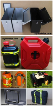

Adventure Motorcycle
Luggage & Accessories
www.coyotetrips.com
Aluminum Panniers and Top Cases,
Top Case Adapter Plates,
Tough Motorcycle Fuel Containers, & More
Designed or Curated by an experienced adventure
motorcycle world traveler
Based in Oregon
You won't find these exact products anywhere else;
these are available only from Coyotetrips
(my husband)
Return to the Coyotebroad travel
home page.
Disclaimer
Any activity incurs risk. The author assumes no
responsibility for the use of information contained within
this document.
_______________________________________________
If you have read
anything on coyotebroad.com, PLEASE
let me know.
Comments are welcomed, and motivate me to keep writing
-- without comments, I start to think I'm talking to
cyberair. I would welcome your
support for my work as
well.
 Quick Links
Index of resources for women
travelers (how
to get started, health
& safety considerations, packing suggestions, transportation options,
etc.
Advice for women
motorcycle riders and travelers.
transire benefaciendo:
"to travel along while doing good." advice for those
wanting to make their travel more than sight-seeing and
shopping.
my adventures in Europe,
Africa, as well as road trips in the USA.
Advice for camping with
your dogs in the USA.
Saving Money with Park Passes
in the USA.
Suggestions for
Women Aid Workers in Afghanistan (or anywhere in
the world where the culture is more
conservative/restrictive regarding women).
my adventures
in Germany.
Advice for Hotels,
Hostels & Campgrounds in Transitional &
Developing Countries: the Qualities of Great, Cheap
Accommodations.
Disclaimer: Any activity incurs risk.
The author assumes no responsibility for the use of
information contained within this document.
This material is provided as is, with no expressed or
implied warranty.
Permission is granted to copy, present and/or
distribute a limited amount of material from
my web site without charge if the
information is kept intact and is credited to Jayne Cravens.
Please contact me for
permission to reprint, present or distribute these
materials (for instance, in a class or book or online
event for which you intend to charge).
The art work and material on this site was
created and is copyrighted 1996-2022
by Jayne Cravens, all rights reserved
(unless noted otherwise, or the art comes from a link
to another web site).
The personal opinions expressed on this page are
solely those of Ms. Cravens, unless otherwise noted.